Utah Locations: details and photos from points of interest in Utah, click photo to enlarge
Antelope Island State Park (2017)
The state park is close to Salt Lake City. It is on an Island in a salty lake. A long dam connects the park to the main land. In the park live bisons, pronghorns and various birds. During visits with little wind, there are a lot mosquitos and no-see-ums. It does not matter what they are: they bite! Every month a so called start party is organised. Members take their telescopes and everybody is welcome to gaze at the stars. We were lucky to be in the area exactly on the right day.
Antelope Island State Park (UT, 2017)
Antelope Island State Park (UT, 2017)
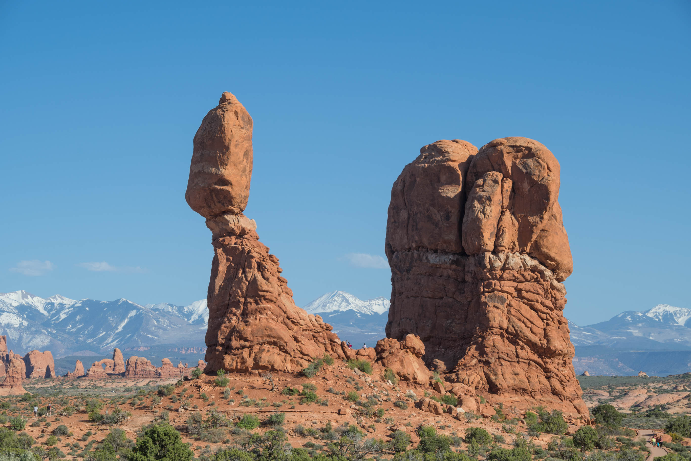
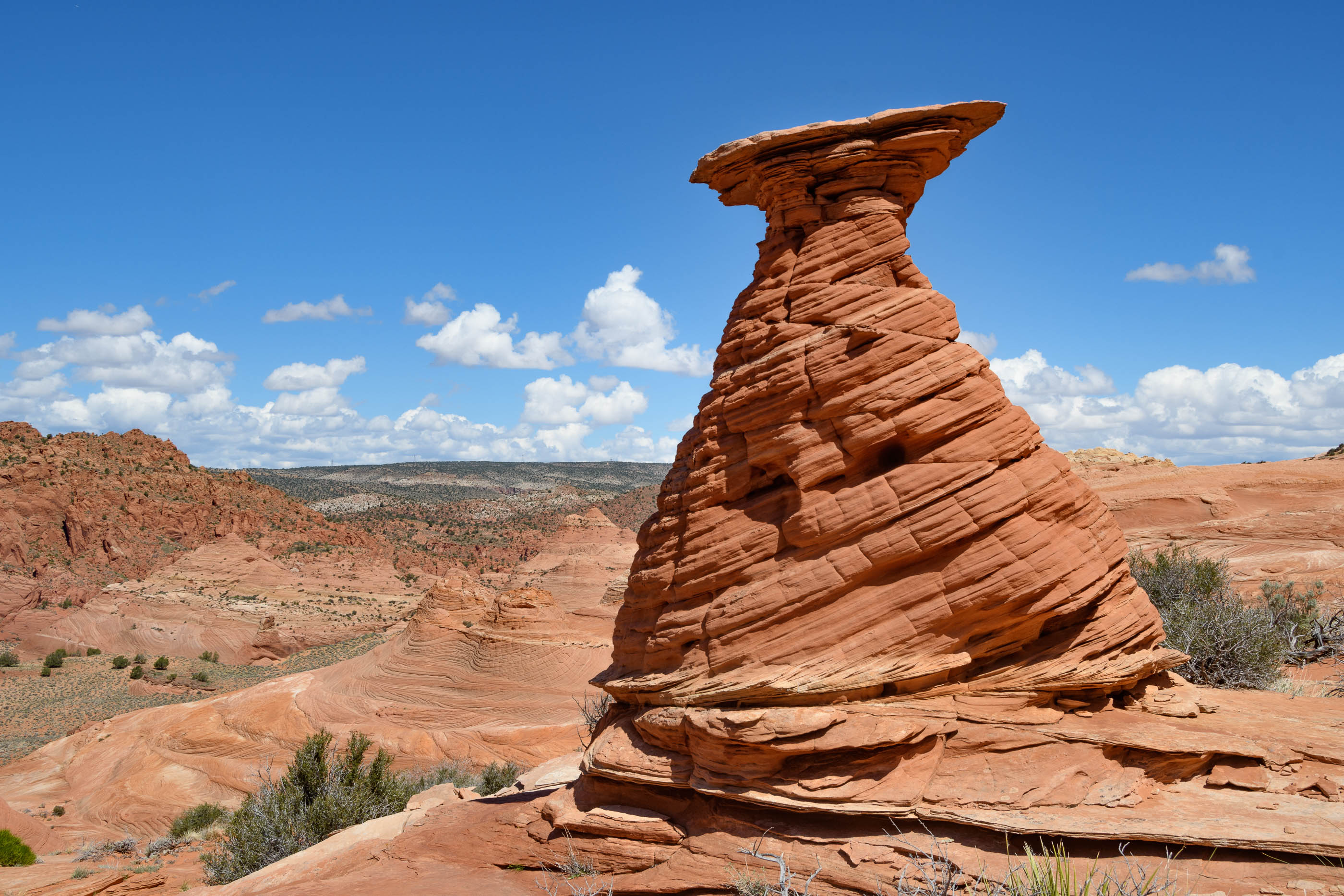
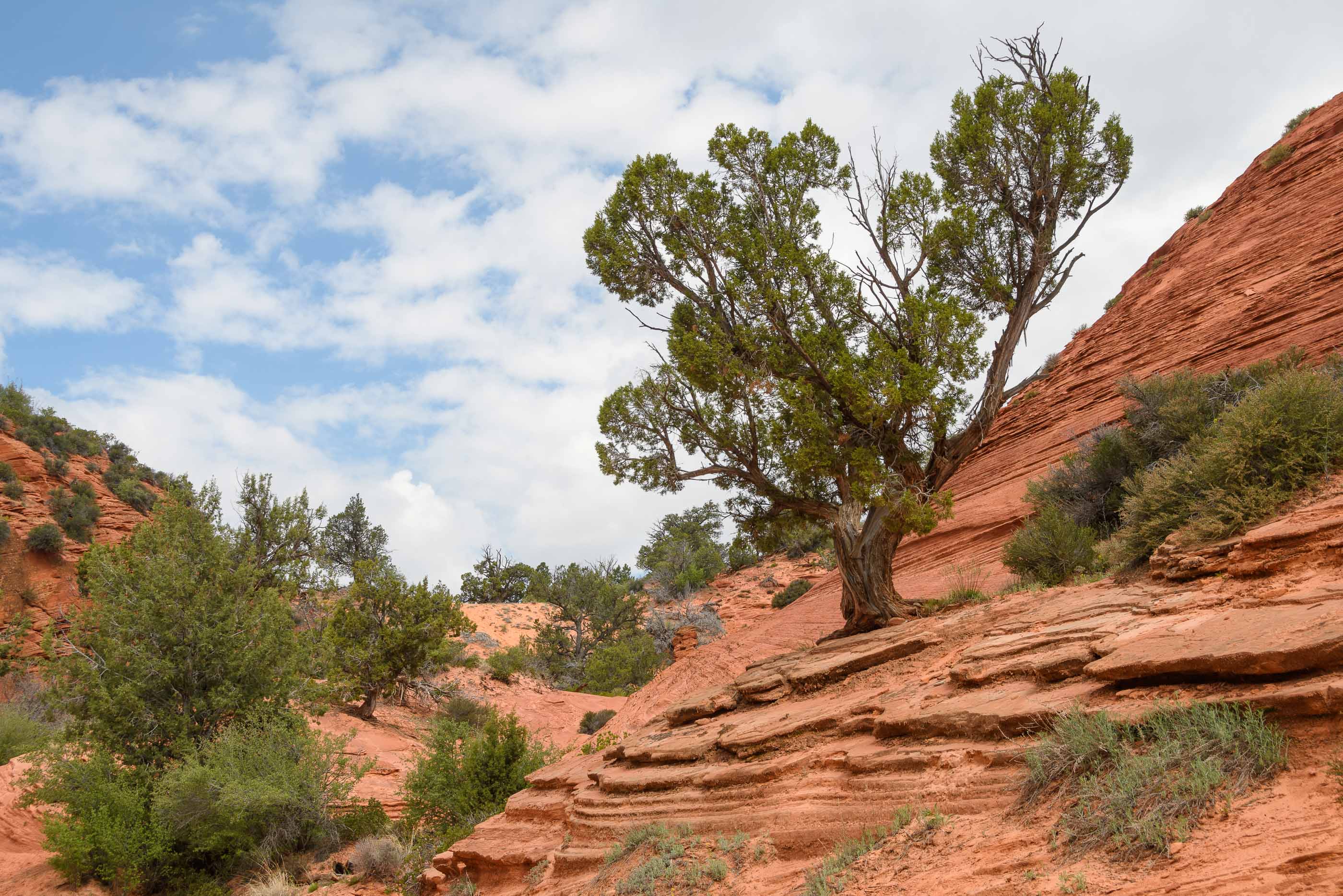
Arches National Park (1995, 2017)
Arches is a very pretty park. The Devil’s Garden Trail and the hike to Delicate Arch are the most famous ones. In 1995, during our first visit, we thought that the Devils garden trail was quite adventurous. By now it was a bit too scary (at least for Monique). So we aborted this hike and enjoyed the other features of the park. The trail to Delicate Arch is easy to do. It is funny to watch the “selfie-theatre” in front of the arch,. No kidding, there is a line-up where people patiently wait until it is their turn to make a selfie.
Balanced Rock, Arches National Park (UT, 2017)
Delicate Arch, Arches National Park (UT, 2017)
Arches National Park (UT, 2017)
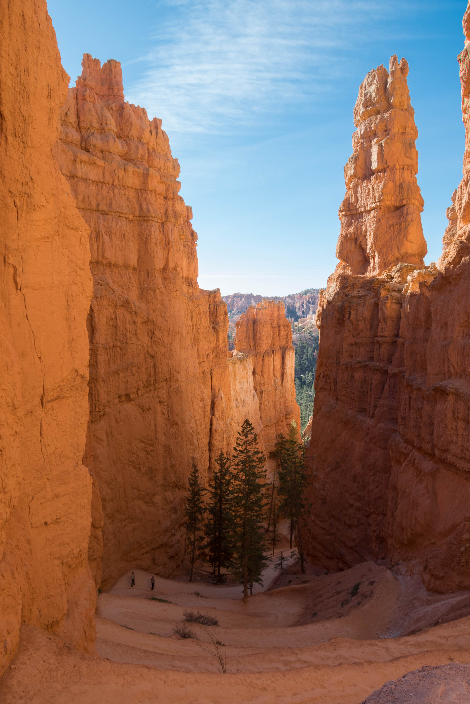
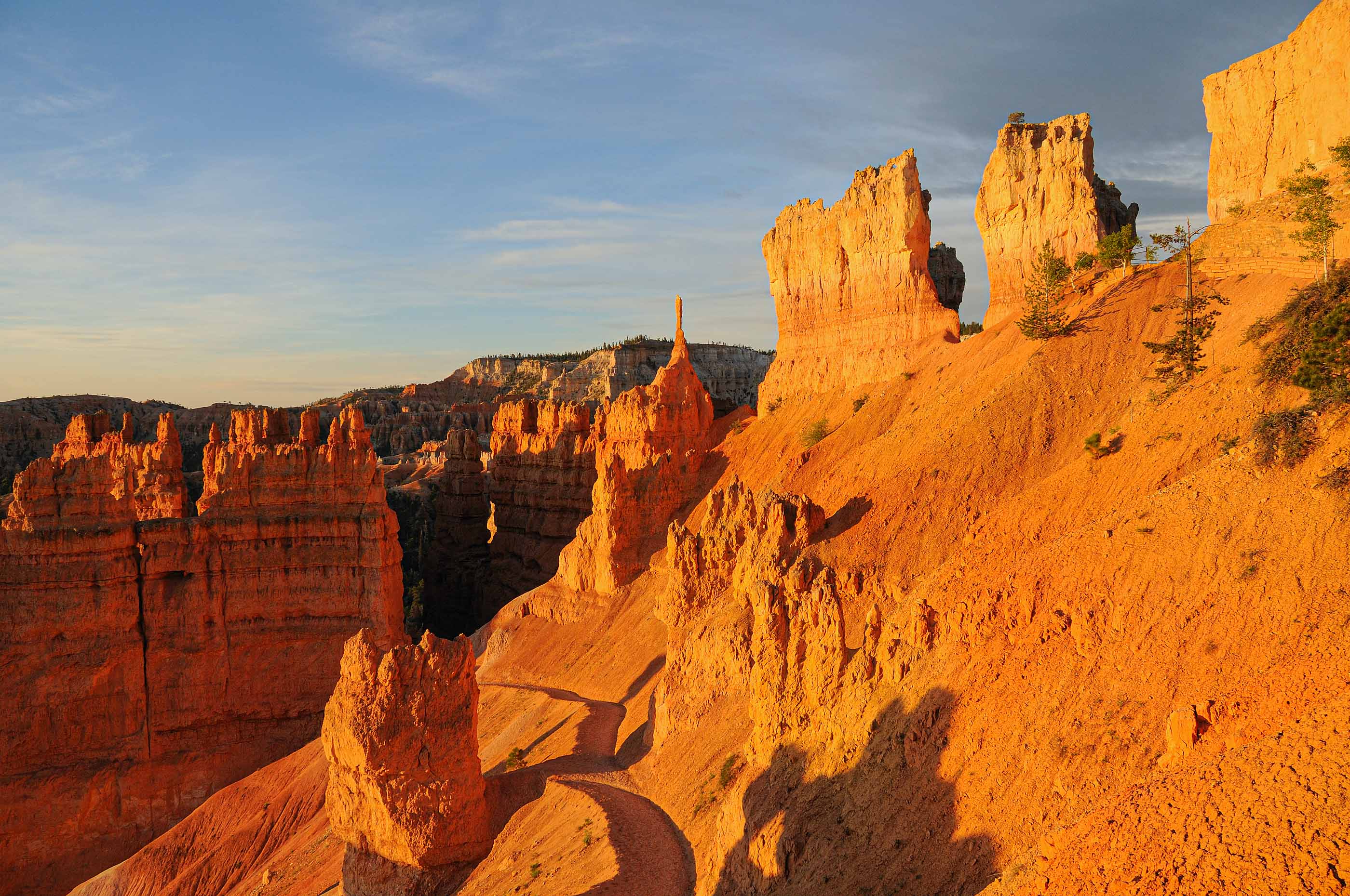
Bryce Canyon National Park (2009, 2017, 2019)
In Bryce canyon 2 types of walks are possible: on the rim and between the hoodoos in the canyon. An interesting short walk is the Navajo trail. This trail is 1.3 miles long. First, the trail descends between towering cliffs. This place is aptly called “Wall street”. Beautiful hoodoo’s rise on either side of the path. The climb back past Thor’s Hammer is not so easy. It is quite a steep climb back up again. Activities in 2009: watch the sunrise at Sunset point and be amazed at the bright red hoodoos. In 2009, 2017 and 2019 we did long hikes: Descend along the Queens garden trail, followed by part of the Navajo trail, which connects to the Peek-a-Boo loop (3 miles). The total length is 10 kilometers, climb and descend nearly 550 meters. It is also nice to do a game-drive in the evening to watch the wildlife on the meadows. Usually it is possible to see at least some deer.
Bryce Canyon National Park (UT, 2019)
Bryce Canyon National Park (UT, 2019)
Thor’s Hammer, Bryce Canyon National Park (UT, 2009)
Zig-zag in Bryce Canyon National Park (UT, 2017)
Wall street in Bryce Canyon (UT, 2009)
Sunrise in Bryce (UT, 2009)
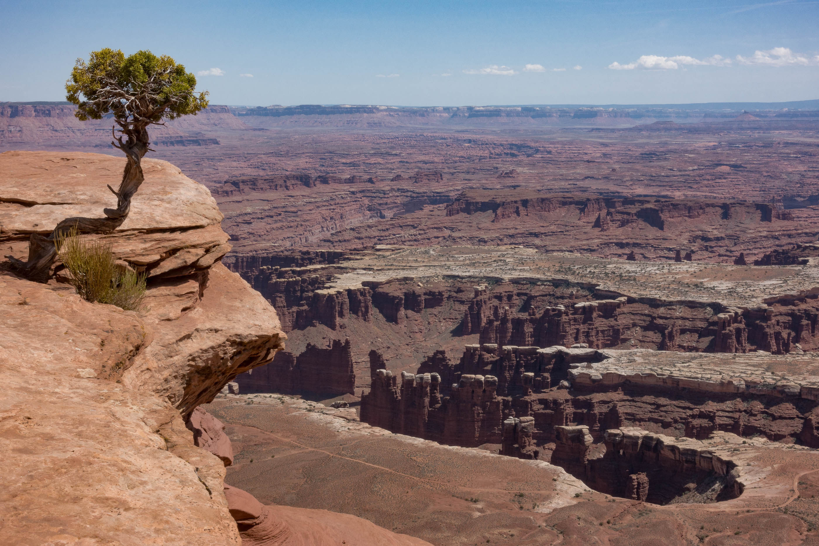
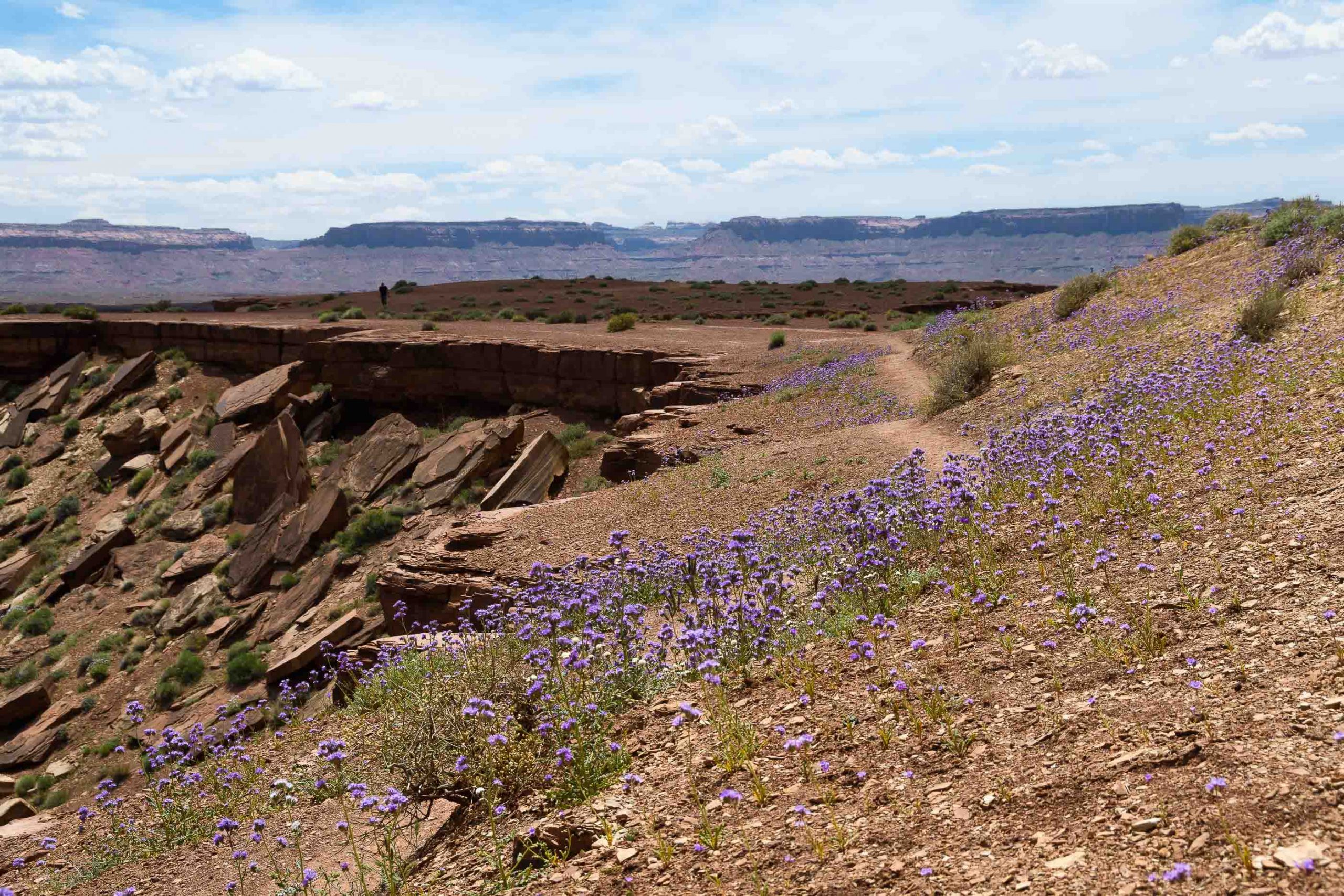
Canyonlands National Park - Island in the Sky (2017)
Canyonlands has several districs of which the entrances are far apart: Island in the Sky, The Needles, The Maze. Further away is Horshoe Canyon. Mesa arch in the early morning is an iconic place to visit. Upheaval Dome shows a colorful rock area, which can be reached after a hike.
Canyonlands National Park (UT, 2017)
Mesa Arch, Canyonlands National Park (UT, 2017)
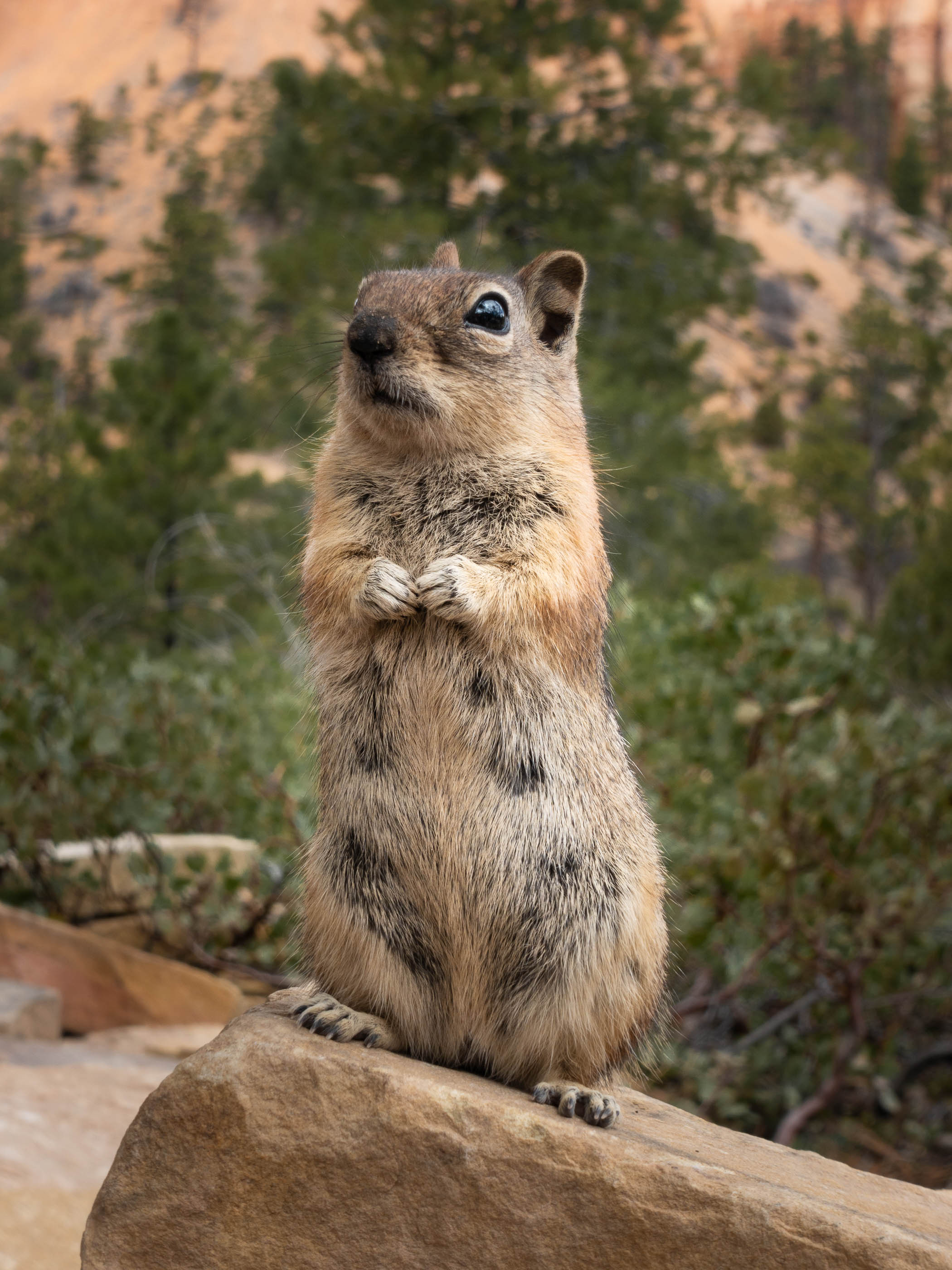
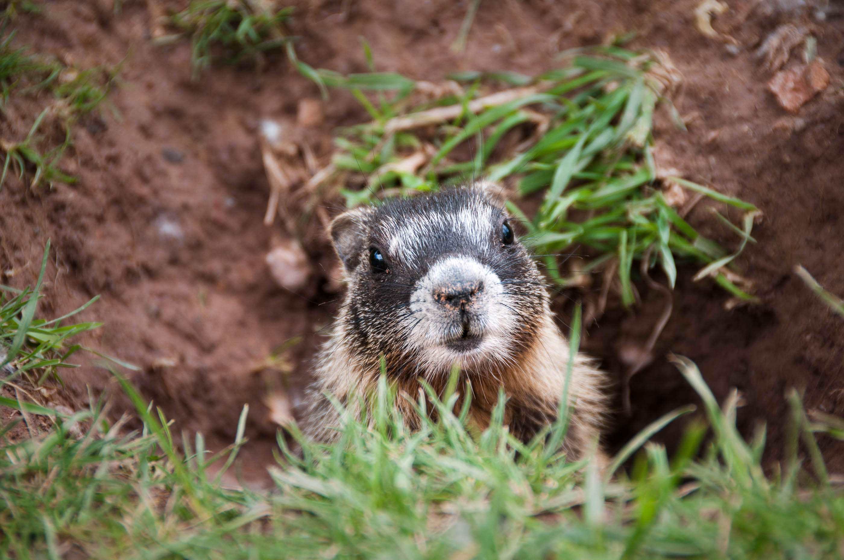
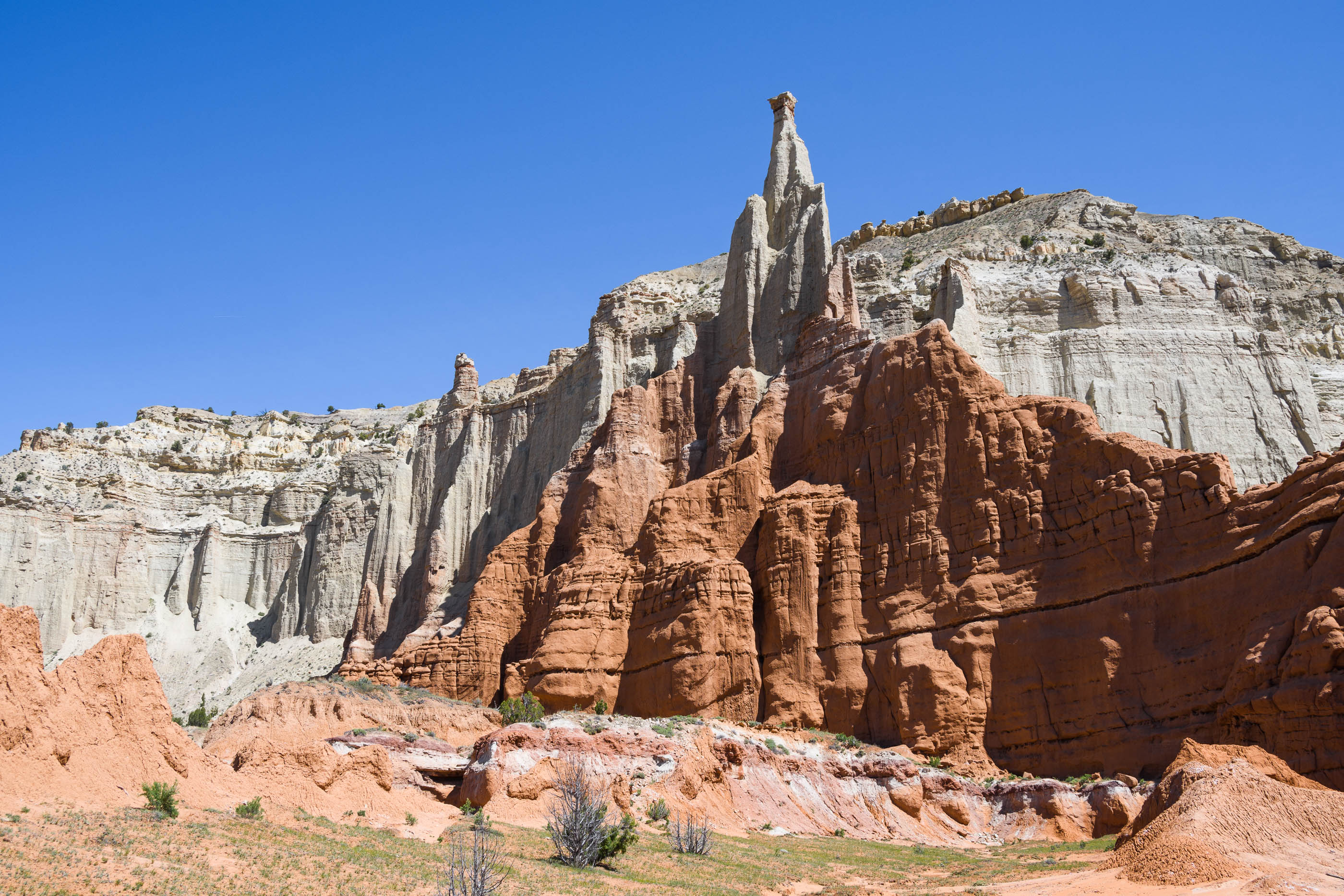
Capitol Reef National Park (2014, 2017)
This national park is very beautifull with steep cliffs and nice vegetation. The old historic district with it’s orchards can be visited. On the rock face some petroglyphs can be seen. It was extremely hot in 2014 so not very suitable to go hiking. In 2017 we went for a re-visit, in April this time, and were able to hike a few gorges.
Barn in Capitol Reef National Park (UT, 2014)
Sunset in Capitol Reef National Park (UT, 2014)
Marmot, Capitol Reef National Park (UT, 2014)
Fremont Petroglyphs, Capitol Reef National Park (UT, 2014)
Cathedral Valley Road (2017)
This 90 kilometer long dirt road is very close to Capitol Reef National Park but not accessible from the park. We travelled about 25% of the road, to the so called Temples of the Sun and Moon. The part closest to the highway has very colorful Chinle formation with bentonite hills.
Temple of the Sun, Cathedral valley road (UT, 2017)
Cedar Breaks National Monument (2014)
In comparison to Bryce the amphitheatre of Cedar Breaks is not very spectacular. There are no trails between the hoodoos, only on the rim. Various viewpoints can be visited from the main road and the rim trail. The elevation is very high, so usally the park is closed until late spring. The park has a grove with Bristlecone pines.
Cedar Breaks National Monument (UT, 2014)
Cedar Breaks National Monument (UT, 2014)
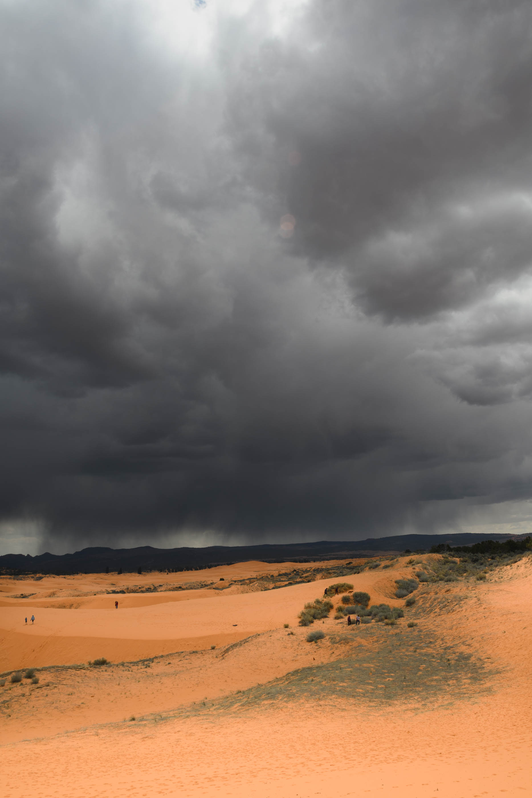
Coral Pink Sand Dunes State Park (2014, 2019)
In 2014 we visited the park during sunset. The orange dunes were very beautiful at that time of day. In 2019 we visited in the afternoon, after a few days of heavy rain. There were puddles of water in the dunes, which were very special to see. In the end, we had to rush back to the car, due to an enourmous thunder storm that was brewing. The approaching clouds and rain were spectacular to observe.
After heavy rain, Coral Pink Sand Dunes (UT, 2019)
Coral Pink Sand Dunes State Park (UT, 2014)
Coral Pink Sand Dunes State Park (UT, 2019)
Dead Horse Point State Park (2017)
This desert park is on a mesa, resembling an elevated island. According to legends in the late 1800’s wild mustang horses were chased onto the mesa via a narrow part, called “the Neck”. After trapping the horses “the Neck” was barricaded and and created a natural corral. The horses the cowboys did not want, were left to die. There is no water on the mesa itself. Water is visible some 700 meter down the vertical ciiffs, but this was unreachable for the horses. The mesa forms the current state park.
Dead Horse State Park (UT, 2017)
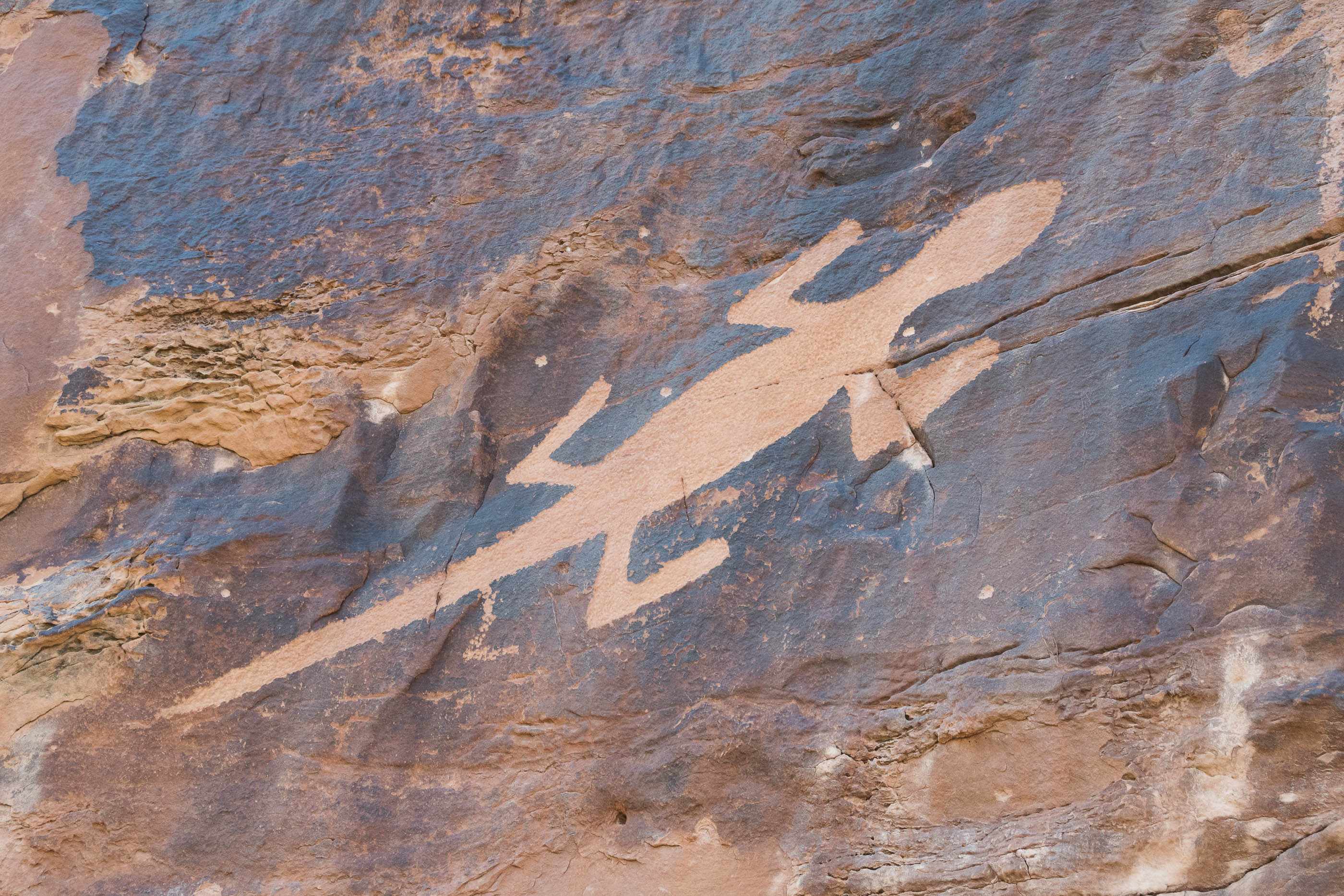
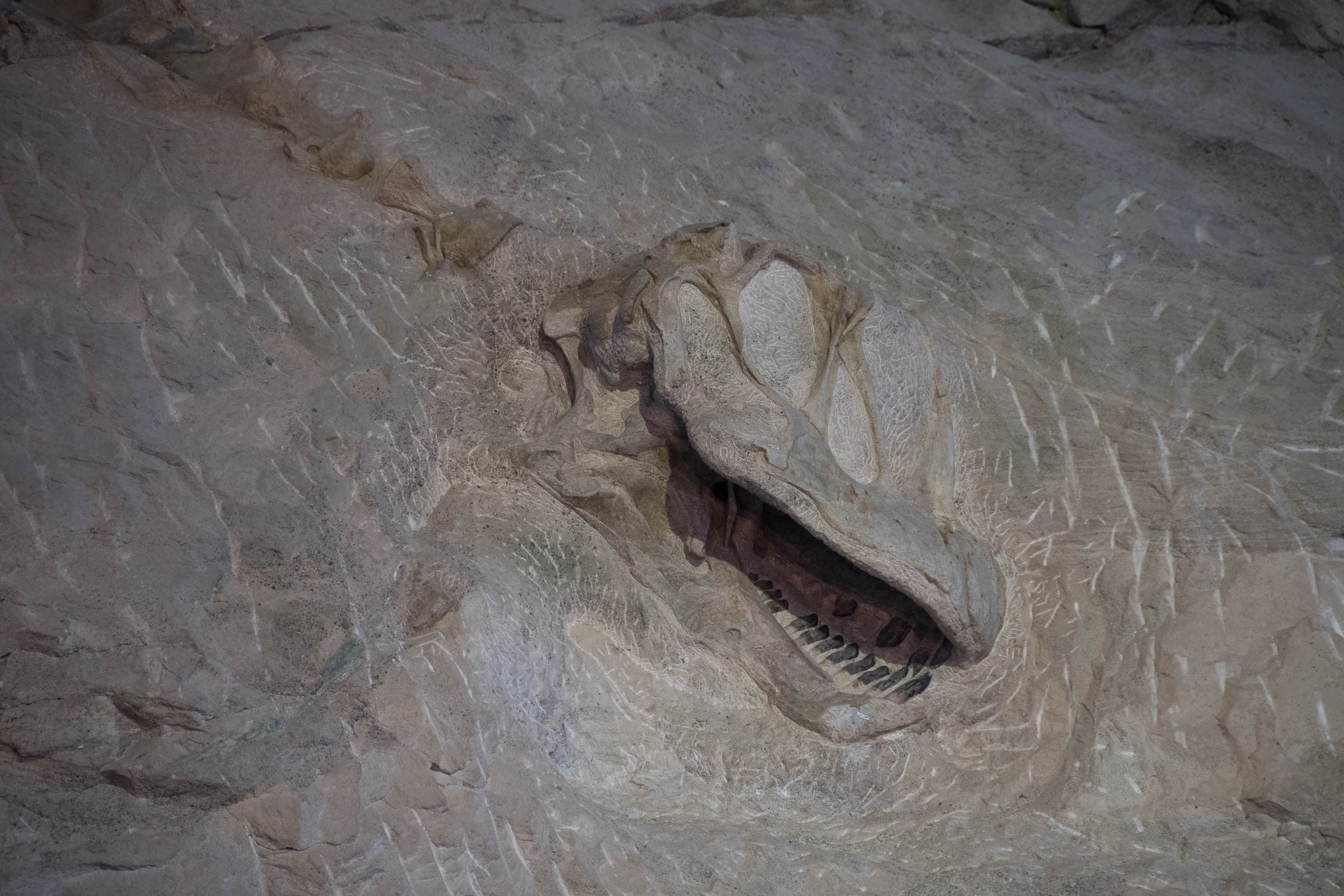
Dinosaur National Monument (2017)
Dinosaur is a 2 state park: Utah and Colorado. The most famous part, the fossil quarry, is in Utah. The main building is build to cover a rock, in which dinosaurs are still partly buried. This way the excavations are open to the public. In 2017 the Colorado-part of the park was closed due to construction, which was a pity, because we planned to visit it.
Rock art in Dinosaur National Monument (UT, CO, 2017)
Rock art in Dinosaur National Monument (UT, CO, 2017)
Dinosaur National Monument (UT, CO, 2017)
Play… (UT, 2017)
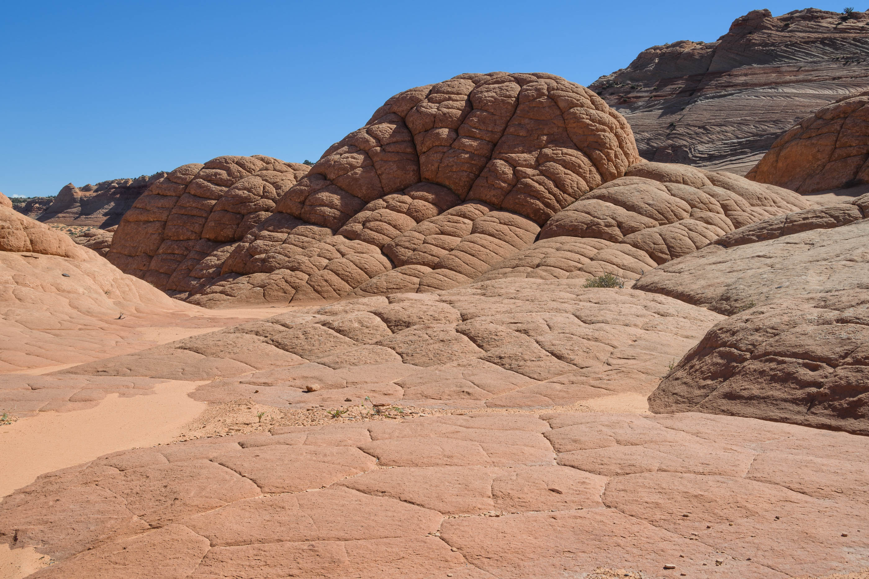
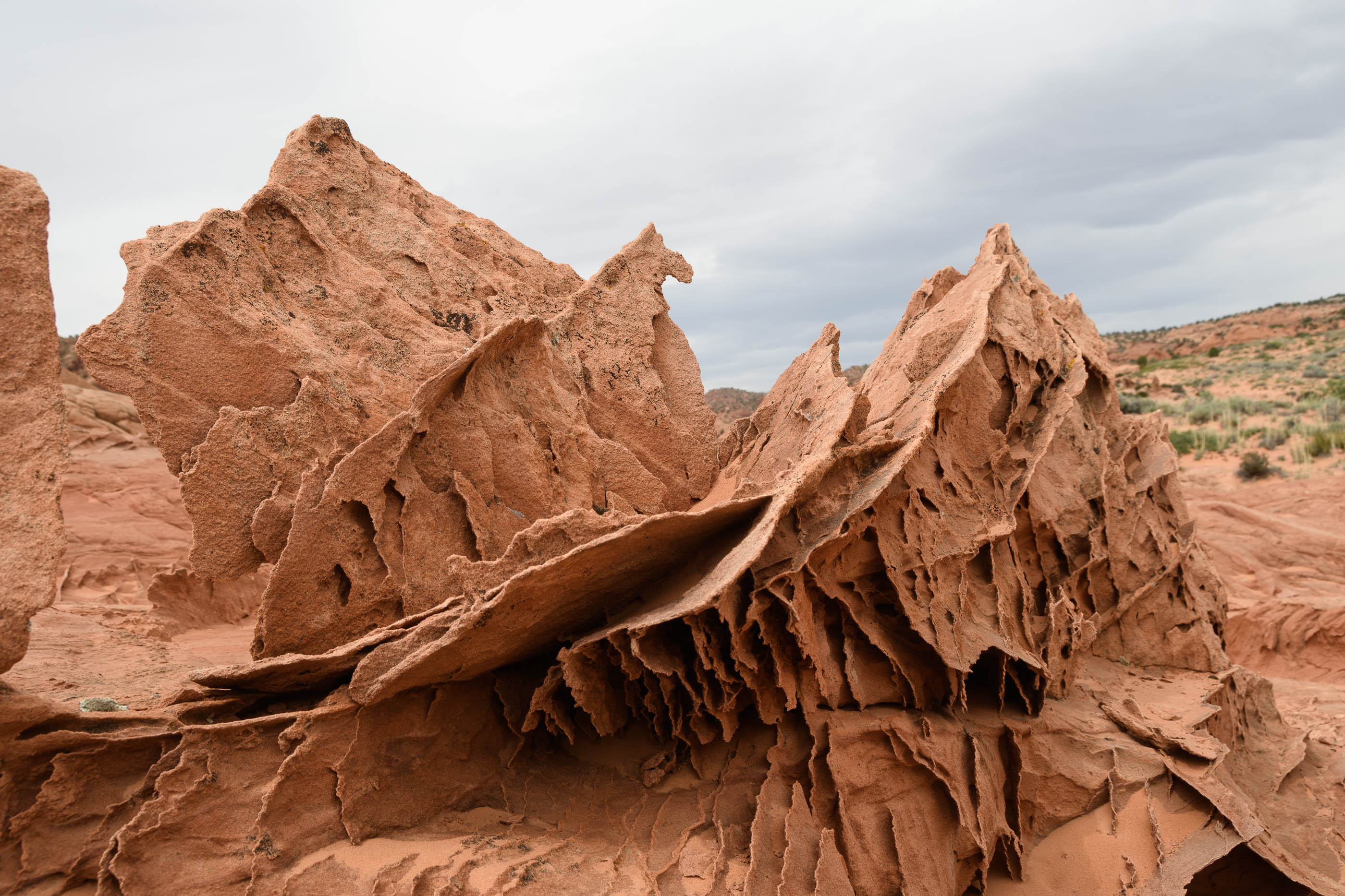
Edmaier's Secret or Brown Pocket (2014, 2017, 2019)
Edmaiers secret is an area with so called brain rocks, but also many other rockformations can be found here. To reach the area, a walk of about 45 minutes is needed, passing a dry river bed. The area in itself is not very big, but for lovers of rock formations a great place to browse. We have visited this area for 3 times now, initially in 2014 on a hot sunny day. We went back in 2017 on a slightly overcast day, which resulted in much softer light. And still we thought there was more to explore, and we went back for a third time in 2019!
Edmaier’s Secret (UT, 2019)
Brain rocks in Edmaier’s Secret (UT, 2019)
Lace rocks in Edmaier’s Secret (UT, 2017)
Brain rocks in Edmaier’s Secret (UT, 2017)
Twisted hoodoo in Edmaier’s Secret (UT, 2019)
Brown pocket in Edmaier’s secret (UT, 2017)
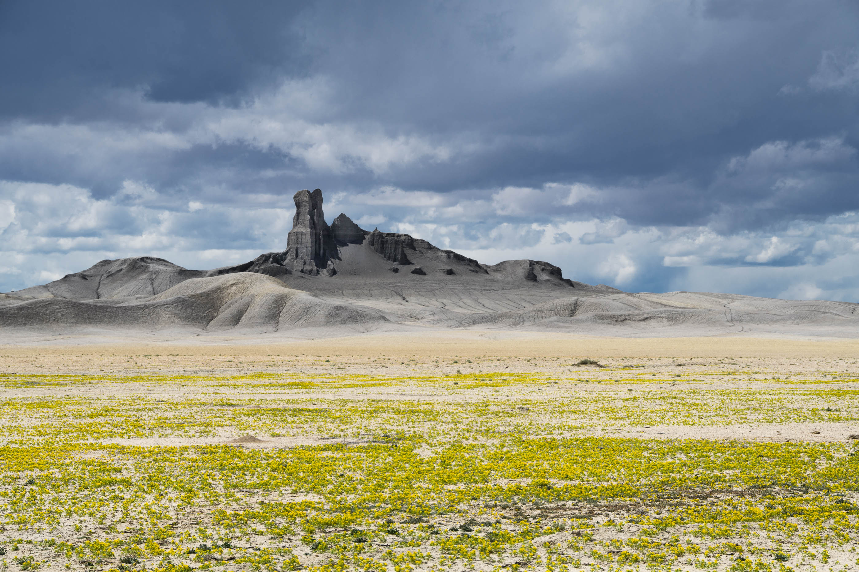
Factory Butte (2019)
This amazing area is located between Hanksville and Torrey. We have passed this road a few times before, and always thought that is looked like a moon-scape with all the beautiful grey tones. This trip we planned a visit. And we are sure, this will not be the last time, it is an amazing area. The Factory butte can be reached via a dirt-road, the Cole Mine Road. It is possible to circle the complete butte, but the road condition deterioriated after a while, wo we went back the same route.
Factory Butte, near Hanksville (UT, 2019)
Factory Butte, near Hanksville (UT, 2019)
Factory Butte, near Hanksville (UT, 2019)
Fallen Roof Ruin (2014)
The ruin is located on Road Canyon and can be reached via a reletively long drive on a dirt road. Regardless of some reain the night before, the road was in good condition. Fallen roof ruin is an interesting place to visit, and not hard to reach.
Fallen Roof Ruin (UT, 2014)
Fallen Roof Ruin, Road Canyon (UT, 2014)
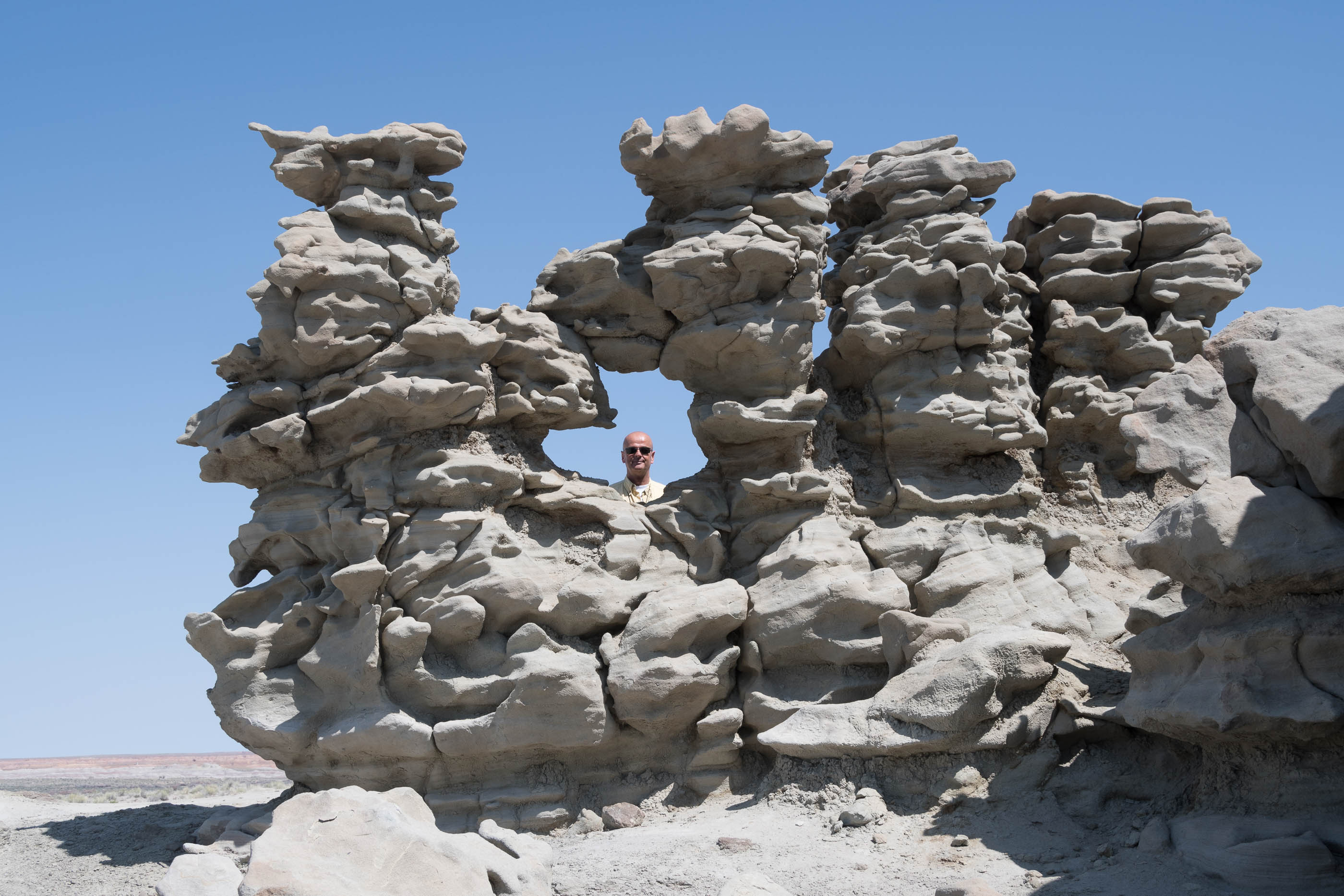
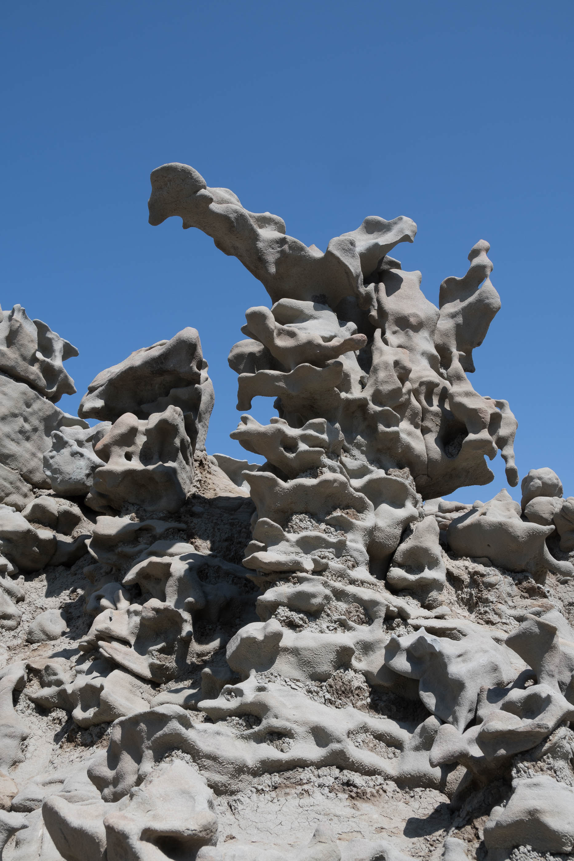
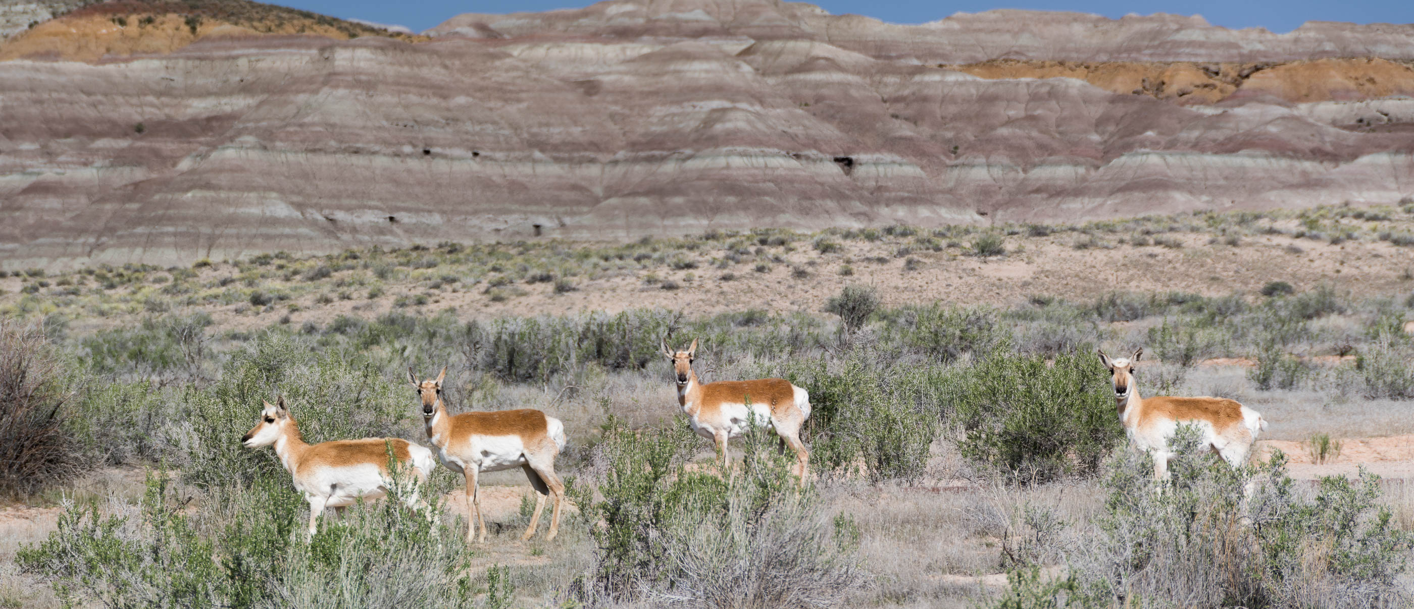
Fantasy Canyon (2017)
Fantasy canyon is a small area that is managed by BLM (Bureau of Land Management). It is accessible via a dirt-road. In the grey rocks all kind of figures can be imagined. This is one of the most unusual places we ever visited.
Pronghorns in Fantasy Canyon (UT, 2017)
Fantasy Canyon (UT, 2017)
Fantasy Canyon (UT, 2017)
Fantasy Canyon (UT, 2017)
Stitch of 2 walking Pronghorn in Fantasy Canyon (UT, 2017)
The trail in Fisher Towers starts a camp ground. The parking can be reached via a short dirt-road of about 2 kilometers. The trail is not very narrow, but it is rather exposed, with a deep and steep cliff directly next to it. At one place a 2 meter drop must be mastered via a vertical metal ladder. It is a very special area, off the beaten track.
Fisher Towers (UT, 2017)
Glen Canyon National Recreation Area (2019)
Glen Canyon’s main feature is Lake Powell. Alongside the road some nice viewpoints are worthy of a (short) break.
Glen Canyon National Recreation Area (UT, 2019)
Glen Canyon National Recreation area (UT, 2019)
Glen Canyon National Recreation area (UT, 2019)
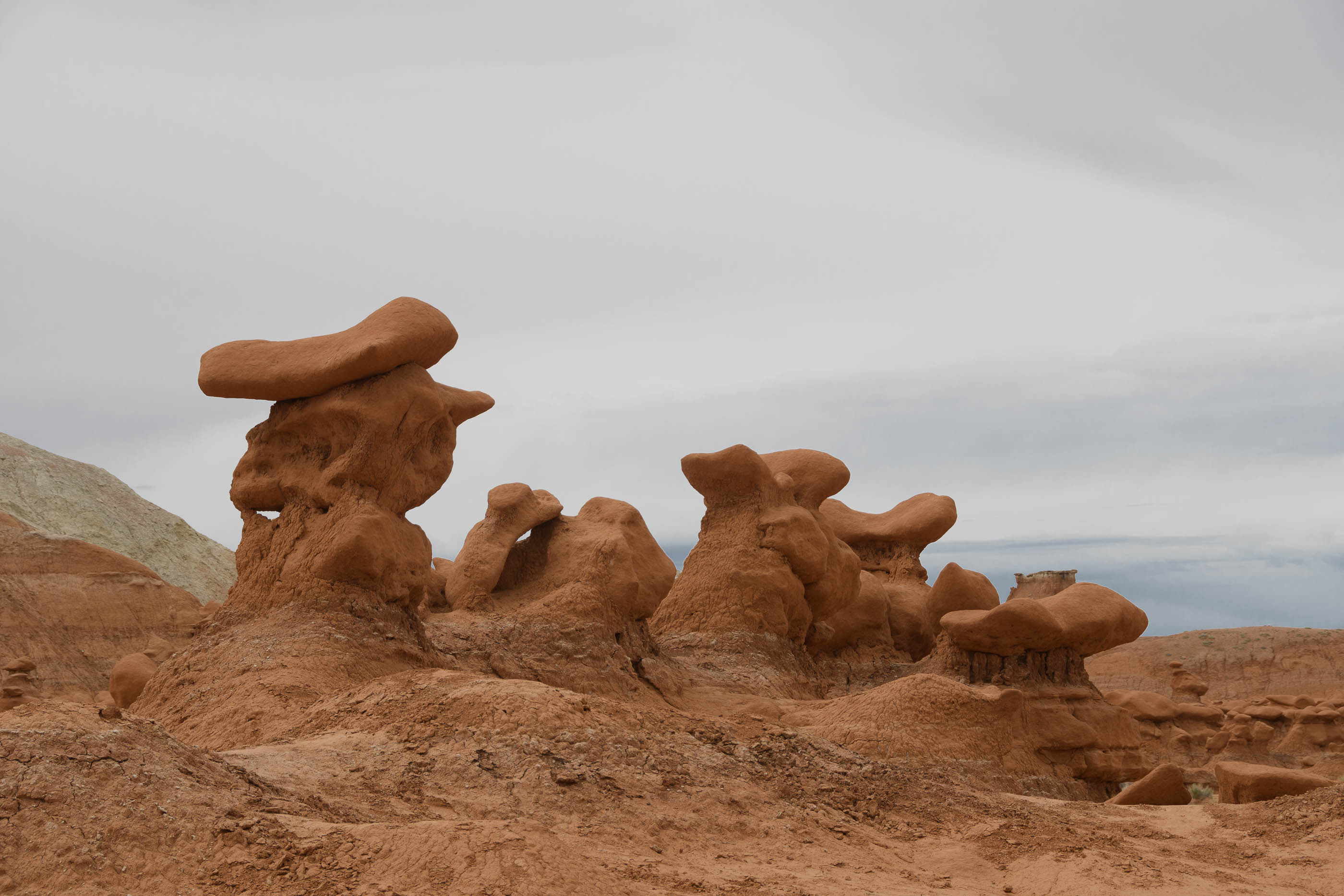
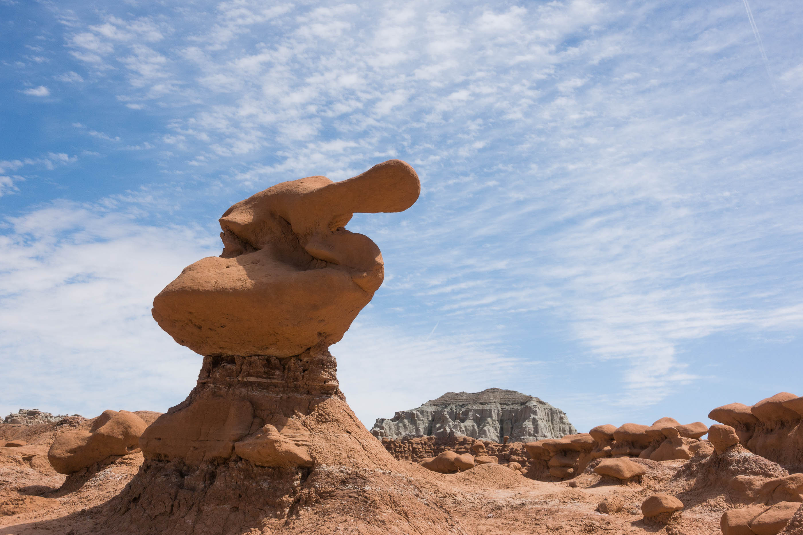
Goblin Valley State Park (2017, 2019)
This state park is really fun to visit. There are no fixed trails. The idea is to roam amoungst the hoodoos and enjoy the views. Most are about 2 meters in height. We had a lovely day, enjoying the scenery, taking pictures, en searching for nice structures! Many resemble persons or animals. We enjoyed a first visit in 2017, in 2019 we went back.
Goblin Valley State Park (UT, 2019)
Hoodoos in Goblin Valley (UT, 2019)
Hoodoos in Goblin Valley (UT, 2019)
Goblin Valley State Park (UT, 2017)
Duck in Goblin Valley State Park (UT, 2017)
Goosenecks State Park (2014)
Goosenecks is extremely boring, at least we think so. Nice to look for 10 minutes to the meandering river, but other than that we have not discovered anything to do here.
Goosenecks State Park (UT, 2014)
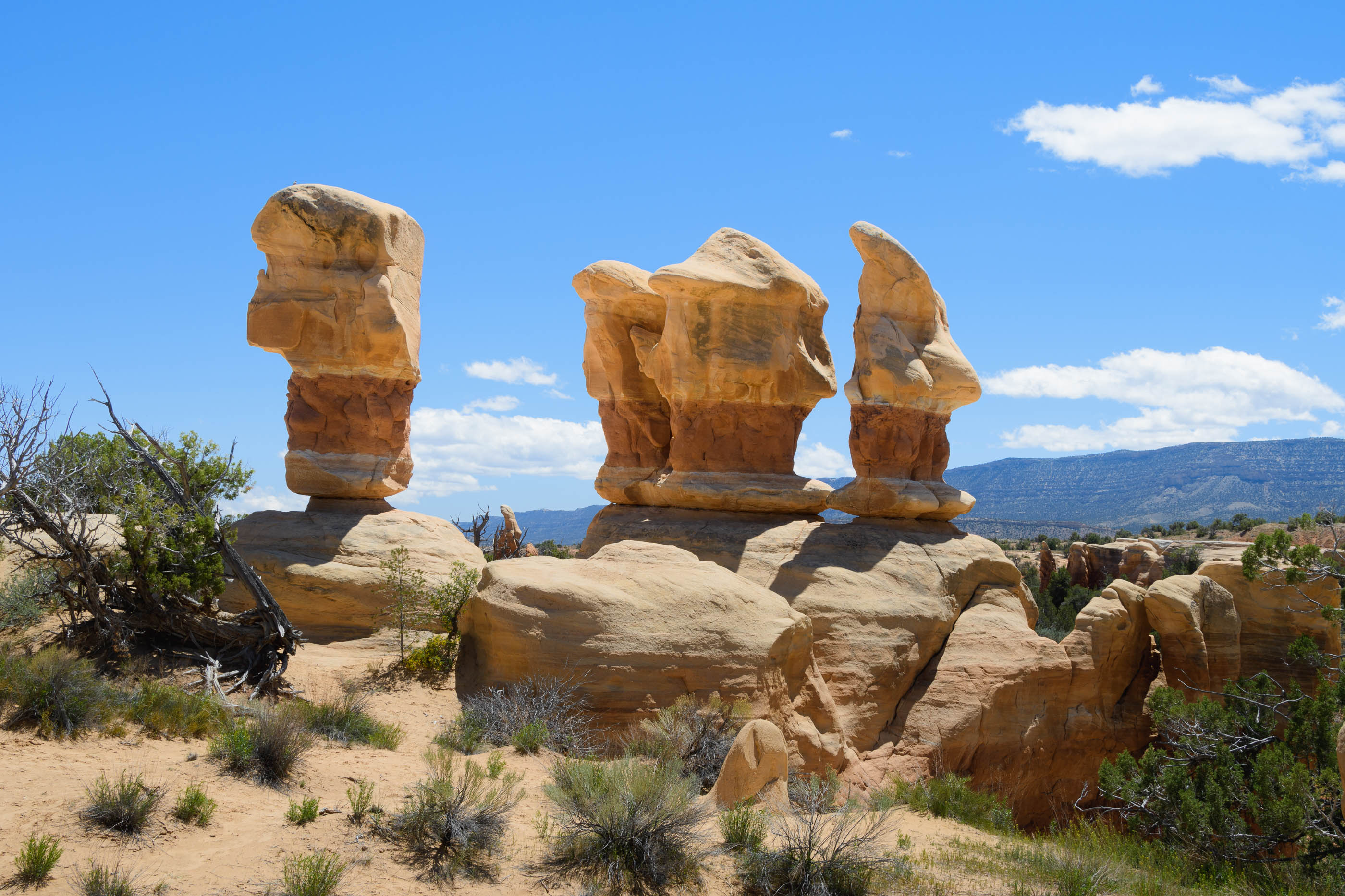
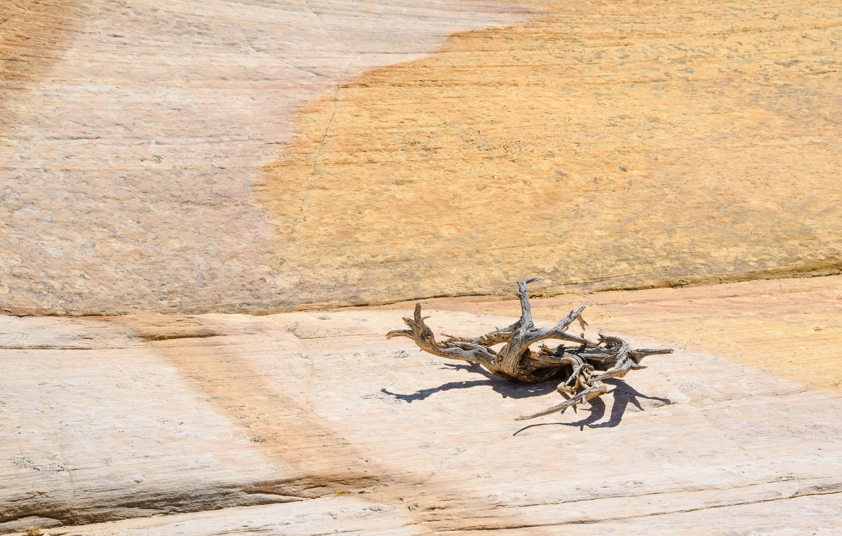
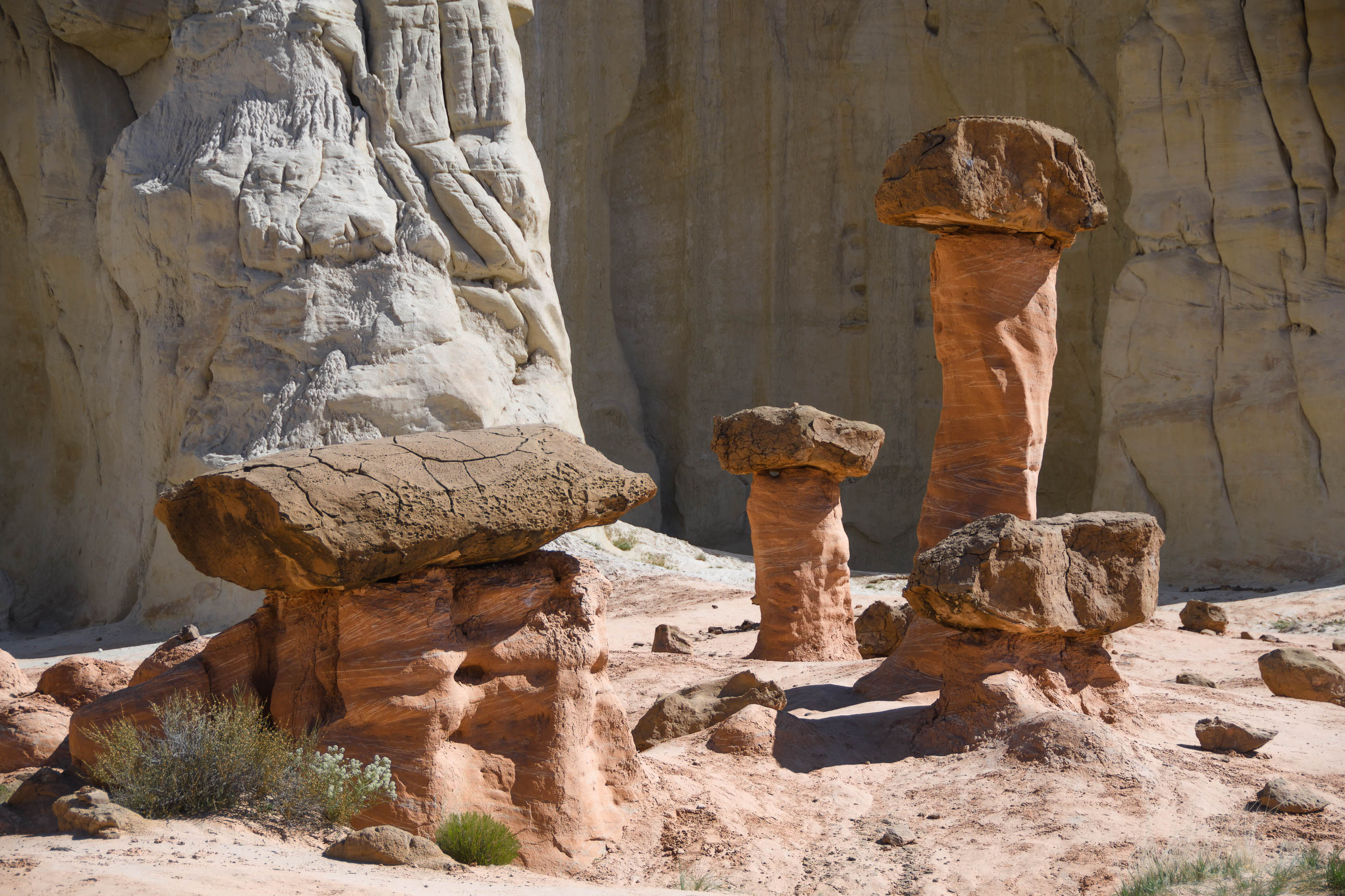
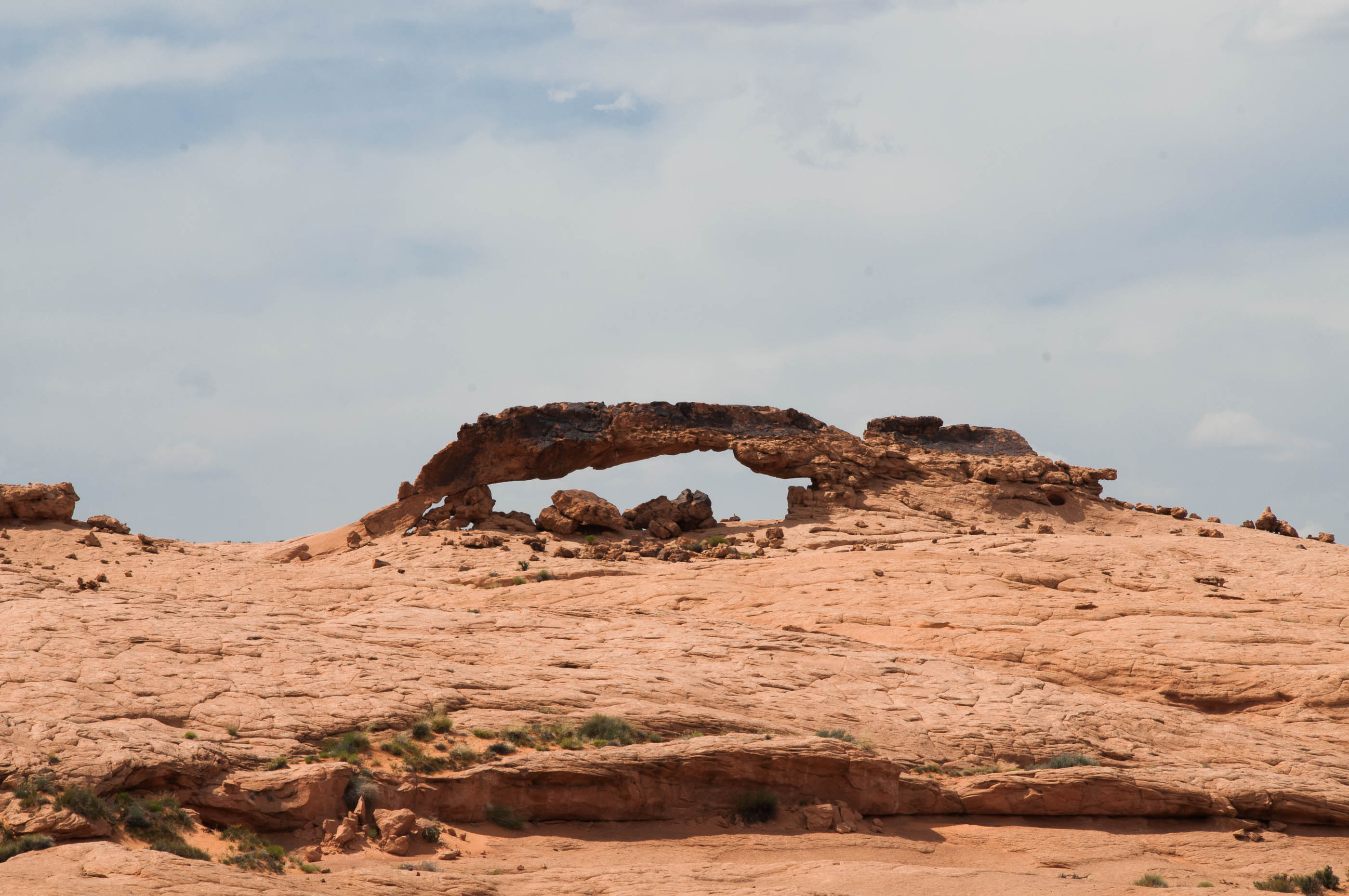
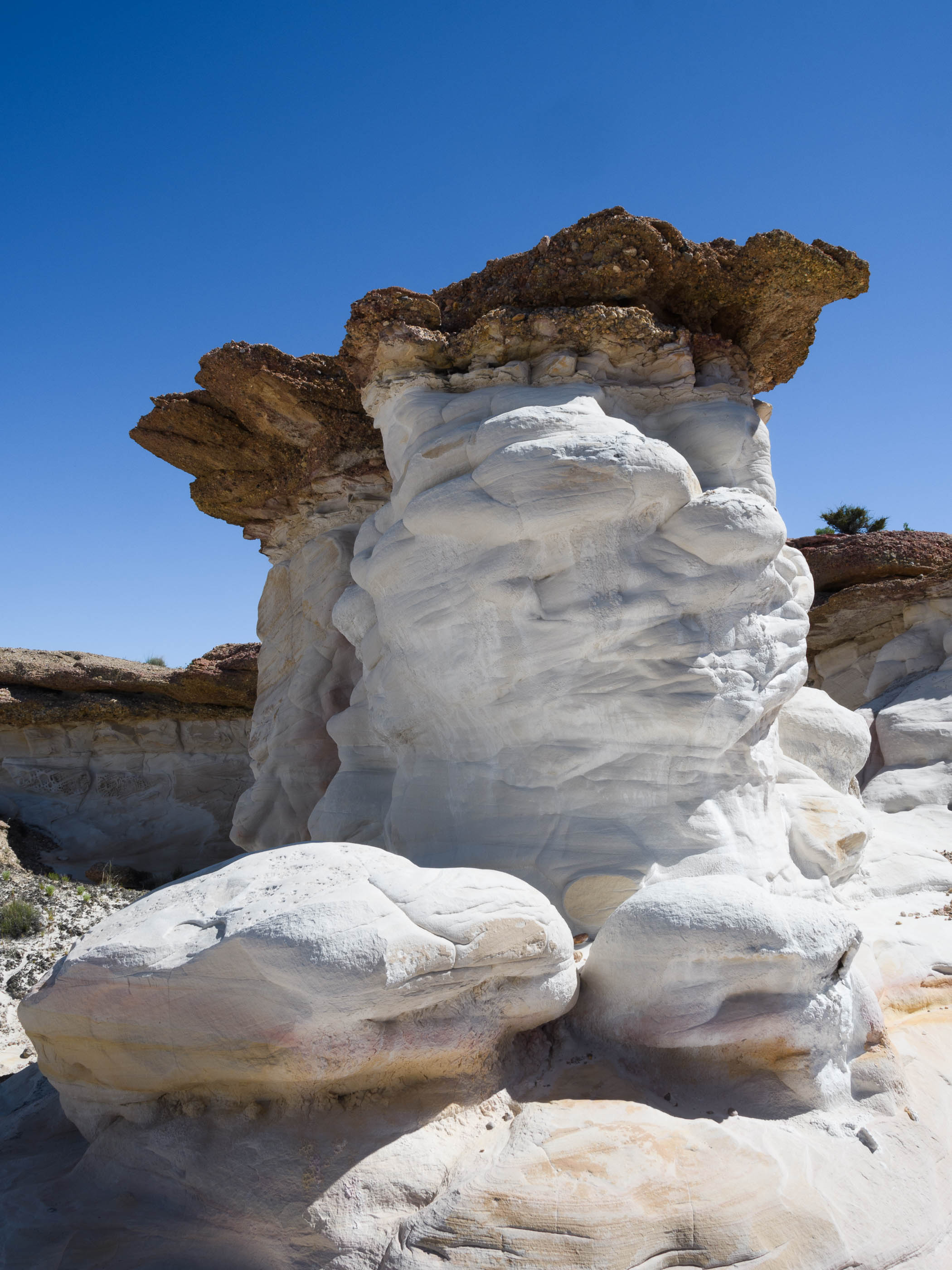
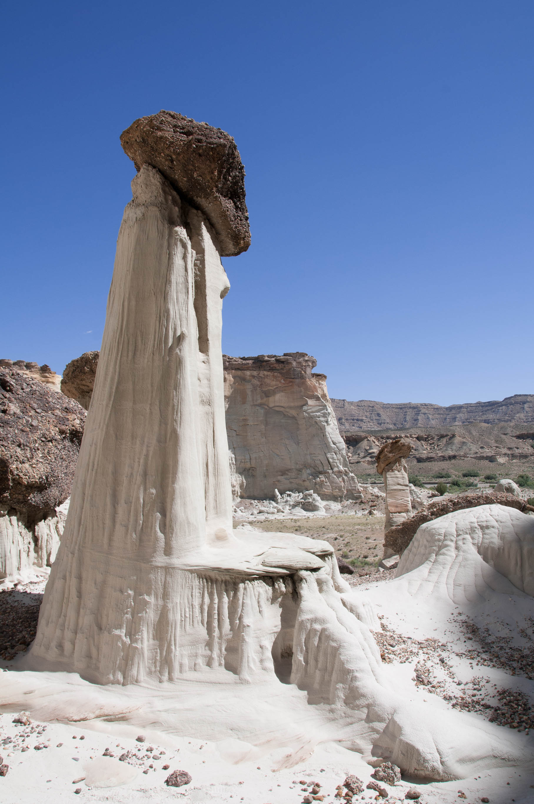
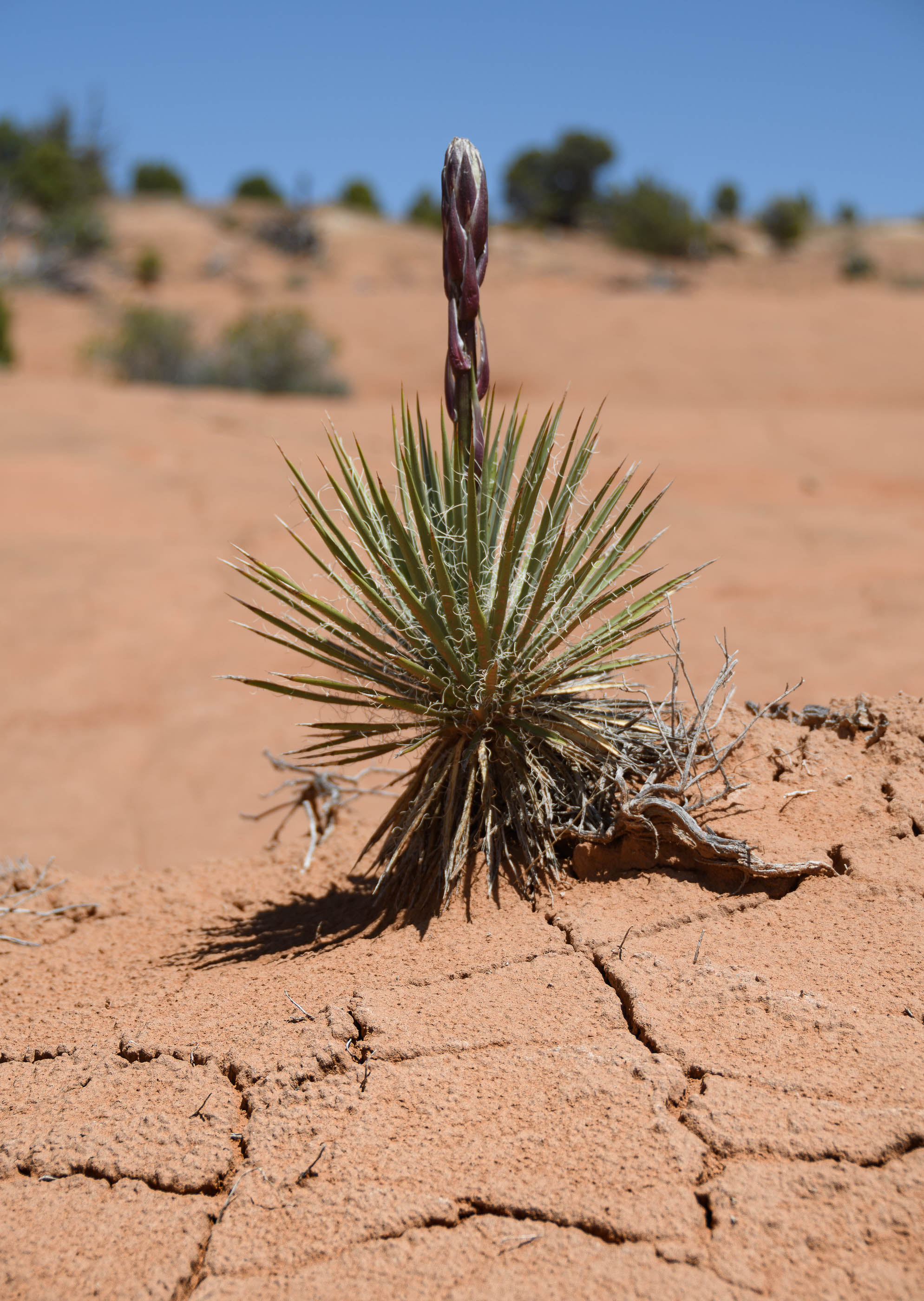
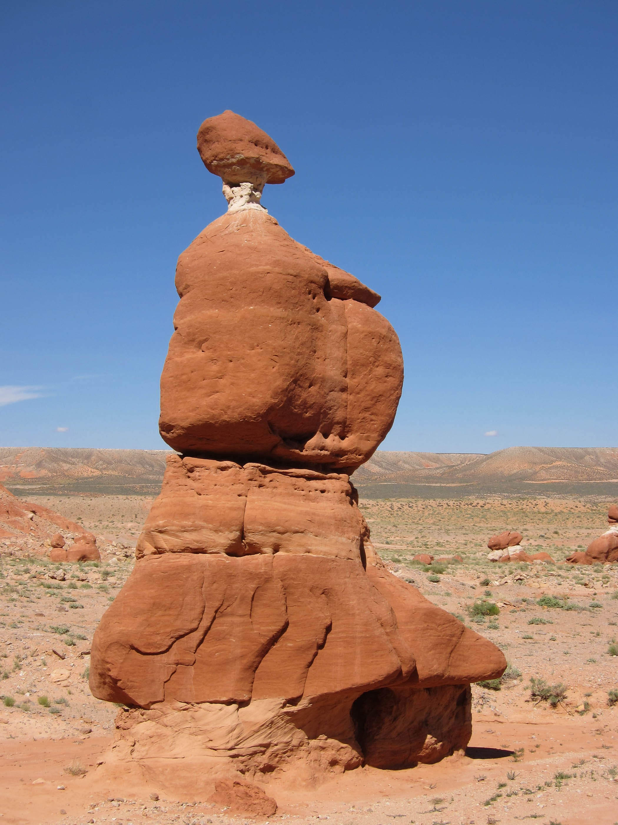
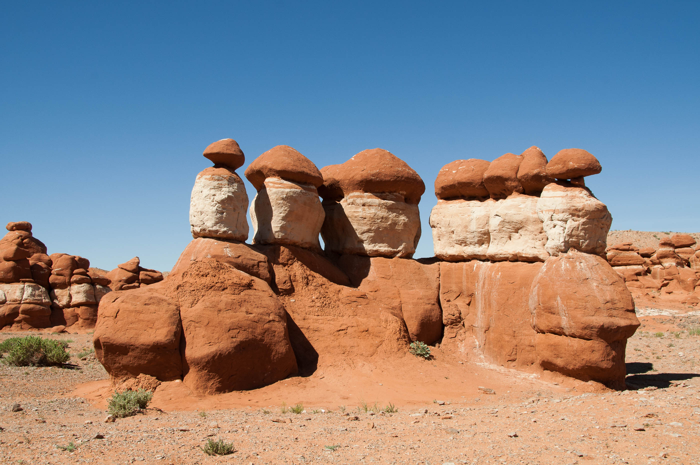
Grand Staircase Escalante National Monument (GSENM) (2014, 2017, 2019)
Grand Staircrase Escalante is a very large and intersting area, with many access points. – Devils Garden (2014, 2019) is located along the unpaved Hole-in-the-Rock road. It is small area with arches and hoodoos. – Buckskin Gulch & Wirepass slot canyon (2014) is the longest and deepest canyon in America (more than 20 km). When reaching the T-crossing, turn to the right for the deepest, narrowest and darkest part; going to the left gives access to the wider part. Some scrambling is needed to pass areas in Wirepass. – The lower Falls of Calf Creek (2014) can be reached by a 4 kilometer walk. The trail gently descents and ascents. – Moqui or Moki Hill (2019) is the place to spot moqui/moki marbles. Small marbles are about 1 cm, the bigger ones about 5 centimeter in diameter. At the time of visit, the dirt-road, Spencer Flat Road, was not in top-condition after last day’s rain. – Nautilus (2014) is a very rare rock formation. The inside looks a bit like the inside of a Nautilus shell. – Paria movie set (2014) is along Paria River Road. The movie set has been destroyed by fire. The area is very picturesque. – Spooky Gulch (2014) is located 27 miles into the Hole-in-the-Rock road. The hike to the actual site needs a crossing on a scary, very narrow ledge. Spooky is a very narrow canyon. – Sunset & Sunrise Arch (2014) are 65-70 kilometer into the Hole-in-the-Rock road. The quality of the last part of the road is 4-wheel drive only. We parked the car when we reached an area with loose sand. The arches itself are nice to visit, but not spectacular. We wanted to find the rock that is resting on stilts. – Toadstool hoodoos & Rimrocks (2014, 2017, 2019) can be reached after a short walk. There are 2 plateaus with hoodoos, one directly behind the Toadstool, another plateau with mostly white hoodoos, a little further to the north west of the main plateau. – Wahweap hoodoos (2014) are 3 areas with white hoodoos – White Rocks/White Valley (2017, 2019) is a very colorful area with hoodoos
Map Grand Staircase Escalante National Monument (GSENM) (USA Utah)
Devil’s Garden, GSENM (UT, 2019)
Non poisonous Gopher snake in Devil’s Garden in GSENM (UT, 2014)
Metate Arch in Devil’s garden in GSENM (UT, 2014)
Paria River Road, GSENM (UT, 2014)
Moqui/Moki marbles, GSENM (UT, 2019)
Moqui Marbles in GSENM (UT, 2019)
Moqui Marbles in GSENM (UT, 2019)
Spooky Gulch in Grand Staircarse Escalante (UT, 2014)
Dead branch in Yellow Rock, GSENM (UT, 2019)
Orange part in Yellow Rock, GSENM (UT, 2019)
Toadstool hoodoos, GSENM (UT, 2019)
Rimrocks, GSENM (UT, 2019)
Rock on stilts, GSENM (UT, 2014)
Sunset arch/Moonrise arch in GSENM (UT, 2014)
Pink formations in White Valley/White Rocks, GSENM (UT, 2019)
White Valley/White Rocks, GSENM (UT, 2019)
Pink and orange formations in White Valley/White Rocks, GSENM (UT, 2019)
Wahweap hoodoos, GSENM (UT, 2014)
Wahweap Hoodoos, GSENM (UT, 2014)
Yucca, Devil’s Garden, GSENM (UT, 2019)
Wahweap hoodoos, GSENM (UT, 2014)
Nautilus, GSENM (UT, 2014)
White Rocks/White Valley, GSENM (UT, 2017)
Horseshoe Canyon - Canyonlands National Park (2017)
This part of Canyonlands National Park is miles away from the other 3 areas. The dirt road to reach the parking is about 50 kilometer one way. As it was windy, there was quite some loose sand on the road, which we were just able to pass. Horseshoe canyon has several locations with rock art. The hike to the Great Gallery, he most famous panel, is about 5 kilometer one way with a steep descent into the canyon. The Great Gallery is a “Barrier-style” pane. with about 2 meter high drawings.
Horseshoe Canyon (UT, 2017)
Great Gallery in Horseshoe Canyon, Canyonlands (UT, 2017)
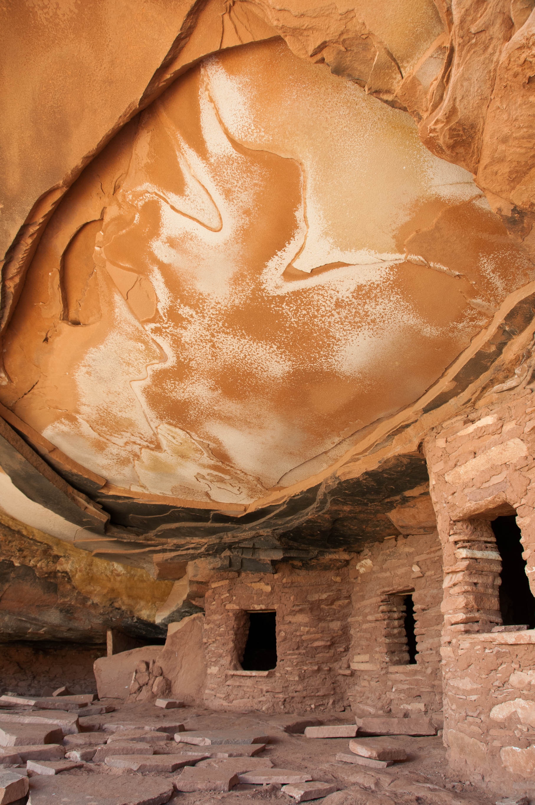
House on Fire Ruin (2014)
This old ruin is located in Cedar Mesa, and can be reached via a short walk through Mule Canyon. The attraction is not so much the ruin itself, but the amazing rock above it. Before direct sunlight hits the ruins, the light is reflected from an opposite rock, making the ruins very well and evenly lit. So this is a good time for photography. An overcast day will do very well too.
House on Fire Ruin, Mule Canyon (UT, 2014)
House on Fire Ruin, Mule Canyon (UT, 2014)
House on Fire Ruin, Mule Canyon (UT, 2014)
Kodachrome Basin State Park (2019)
We passed this park several times, but never visited. So we decided to stop this time. Next times we will just pass it again, we were not impressed.
Kodachrome Basin State Park (UT, 2019)
Kodachrome Basin State Park (UT, 2019)
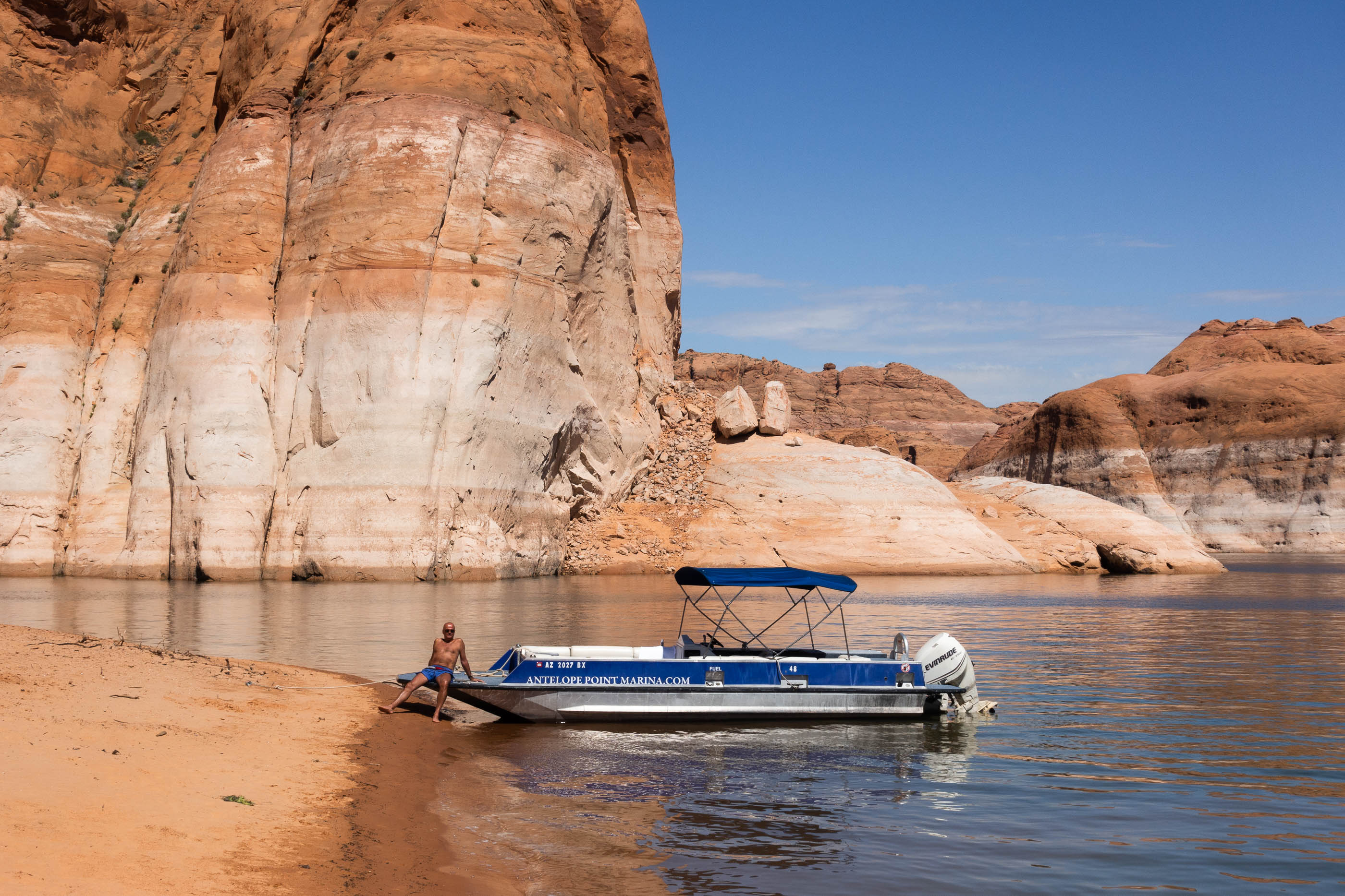
Lake Powell (2019)
On a warm day it is fantastic to spend the day on the water of Lake Powel. At Antelope Point Marina a boat rental company is located. Twice already we rented a boat at this company and cruised the canyons.
Boat rental in Lake Powell (UT, 2019)
Little Egypt (2014, 2019)
Little Egypt is an area with very colorful red and white hoodoos. In 2014 we did not have a lot of time, so we explored only a small part of the area. Because we liked it so much in 2014, we planned a re-visit in 2019. It was too short again! This time the weather was not cooperating. A thunderstorm made us leave.
Little Egypt (UT, 2019)
Little Egypt (UT, 2019)
Little Egypt (UT, 2014)
Little Egypt (UT, 2014)
Little Egypt (UT, 2014)
Loosee Canyon (2019)
Loosee Canyon is a small area very close to Bryce National Park. It has the same kind of red rock structures, but is less spectacular.
Loosee Canyon (UT, 2019)
Arches Trail, Loosee Canyon (UT, 2019)
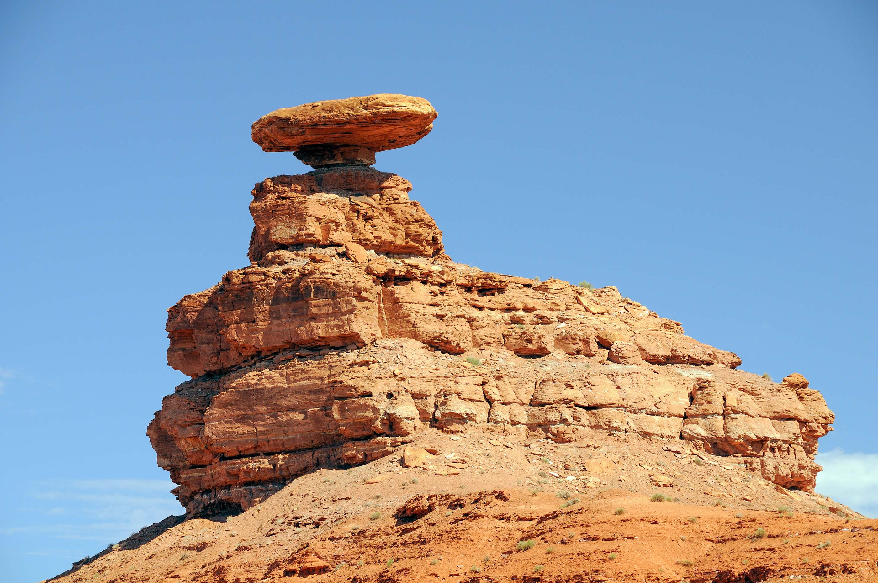
Mexican Hat (2009)
This strangely formed rock can be seen when driving along US163.
Mexican Hat (UT, 2009)
Moki Queen Pictograph (2014, 2019)
The Moki Queen is a well preserved rock painting. It is located in an alcove, close to Hog Springs rest area (at the same side of the road). To access the drawing a small river must be crossed. We were here the first time in 2014, and when we were passing through the area in 2019 we took another look. The condition of the painting is still the same.
Moki Queen (UT, 2019)
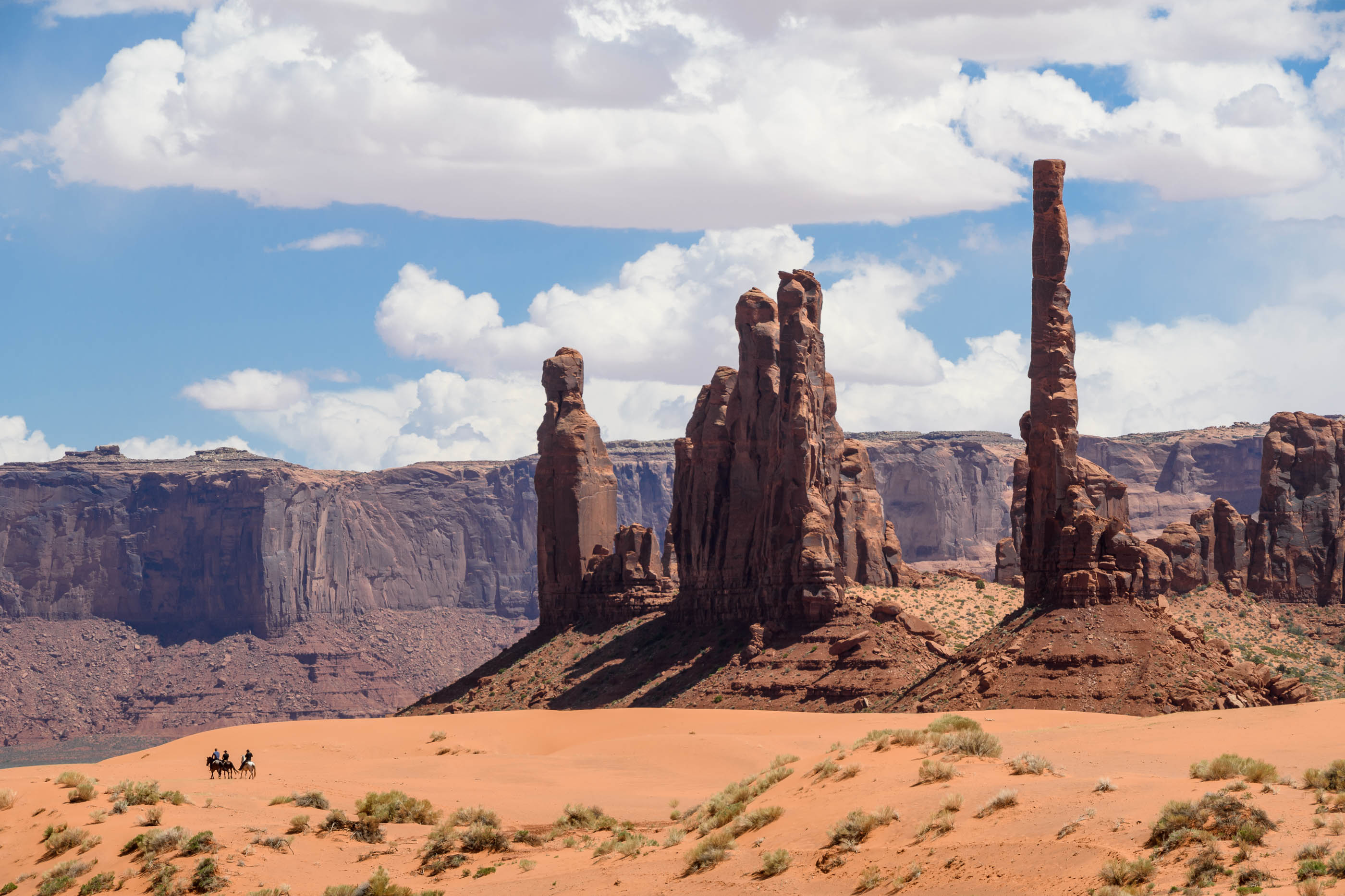
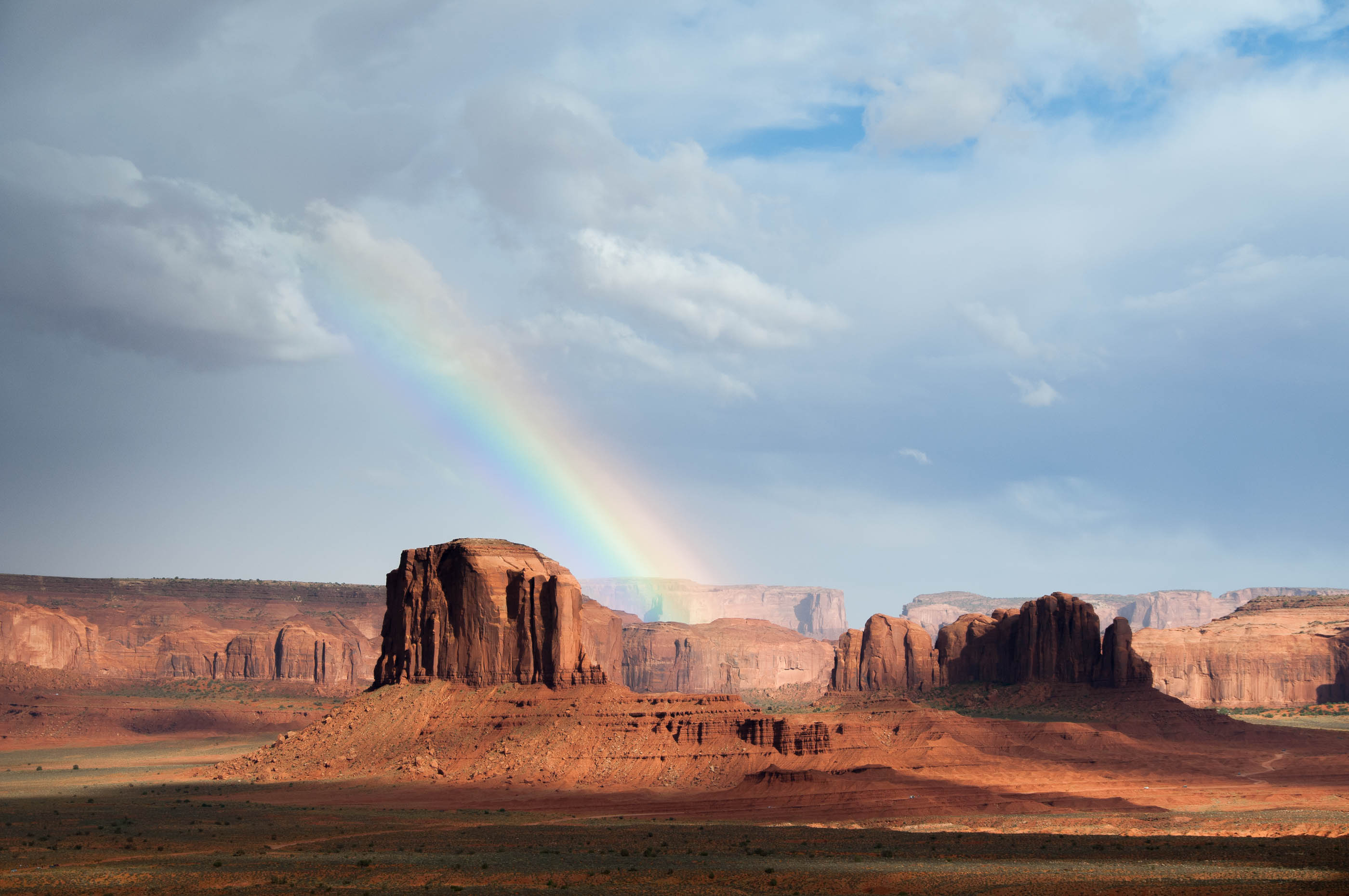
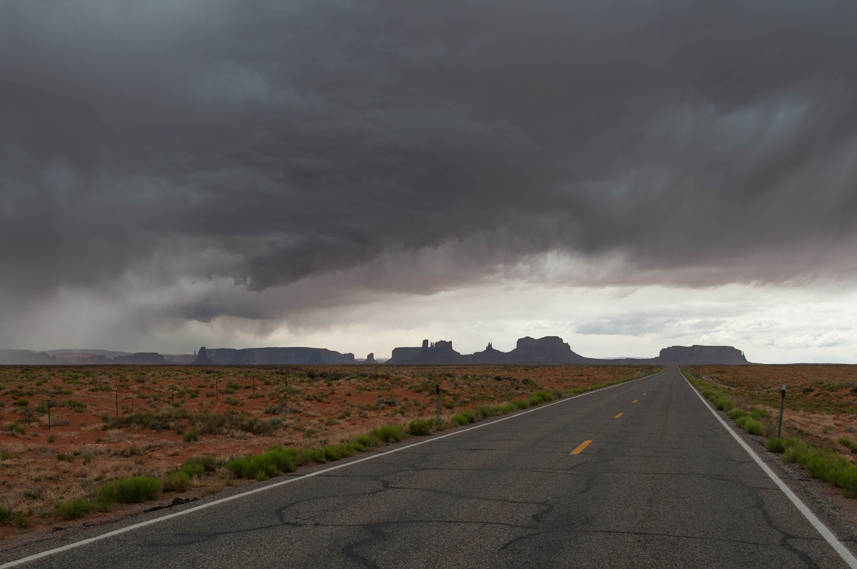
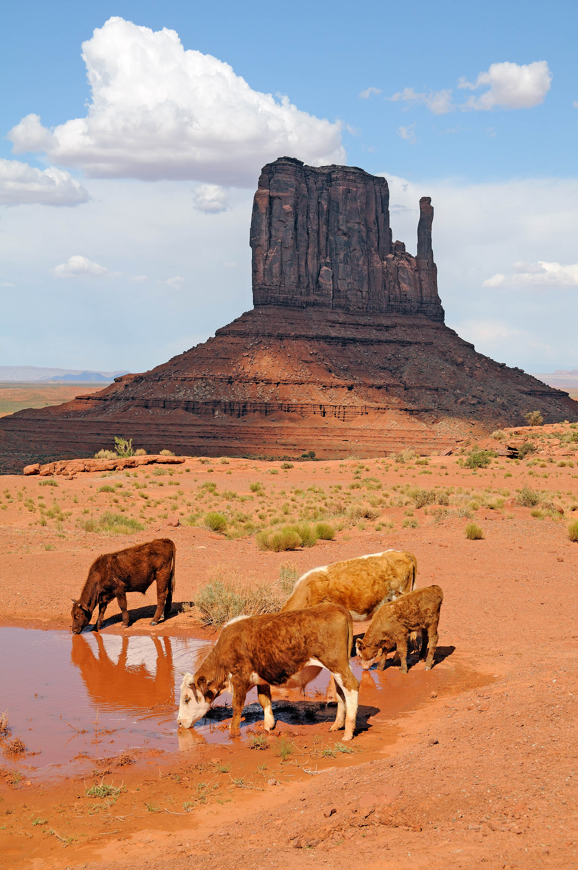
Monument Valley (2009, 2014, 2019)
The official name is “Monument Valley Navajo Tribal Park”. The park is located in 2 states: Arizona en Utah. Kayenta is the closest city. The ‘self guided self drive’ in the park is a very interesting excurstion. In 2009 the road conditions were not too good, so we did not go in. In 2014 we had a suitable SUV, but at the time, our visit was too short to do the complete tour. We did visit the 3 most famous buttes from the dirt-road and from the parking. In 2019 we planned to stay overnight in “The View”, the hotel in the park, so plenty of time to see it all! Some work has been done on the more difficult parts of the dirt-road, making it easier to drive. When it is not too hot, the wildcat trail is an interesting walk. The trail is about 7 km long and runs around the ‘west mitten’. It is well worth the effort, and because the trail leads you around the buttes, you see them from another angle.
Monument Valley (AZ, UT, 2019)
Totem Pole, Monument Valley (AZ, UT, 2019)
Monument Valley at sunset (AZ, UT, 2019)
Monument Valley after sunset (AZ, UT, 2019)
Rainbow in Monument Valley (UT, AZ, 2014)
Rainbow, Monument Valley (UT, AZ, 2014)
Monument Valley (UT, AZ, 2014)
Monument Valley (UT, AZ, 2009)
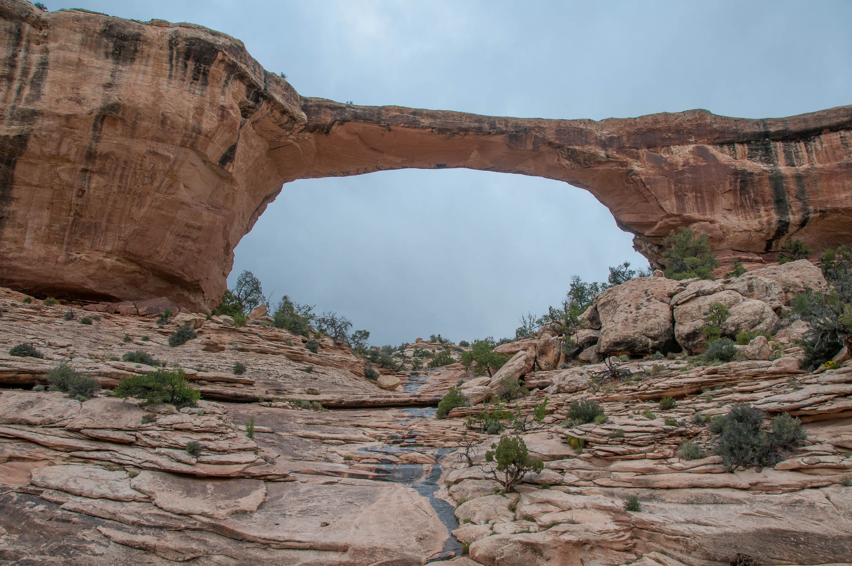
Natural Bridges National Monument (2014)
The main attraction of this park are 3 bridges. Flowing water undercuts the rocks creating meanders. Finally erosion causes the water to flow under the bridge. The bridges can be viewed from above from the viewpoints. Trails give access to the river bed and the bridges can be viewed from below.
Owachomo bridge in Natural Bridges National Monument (UT, 2014)
Kachina bridge in Natural Bridges National Monument (UT, 2014)
Sipapu bridge in Natural Bridges National Monument (UT, 2014)
Petrified Forest Escalante State Park (2019)
We visited this state park, close to Escalante village, by accident. The activity we planned to do, had become impossible due to the rain of the previous day. So we wnt to the petrified forest instead, a trail leads visitors along areas with pretrified wood.
Escalante Petrified Forest (UT, 2019)
Red Canyon Slot a.k.a. Peek-a-Boo Canyon (2019)
Red Canyon Slot is a short but very nice slot canyon. It can be reached via a cross country hike.
Red Canyon Slot, hike to the entrance (UT, 2019)
Red Canyon Slot, a.k.a. Peek-a-Boo Canyon (UT, 2019)
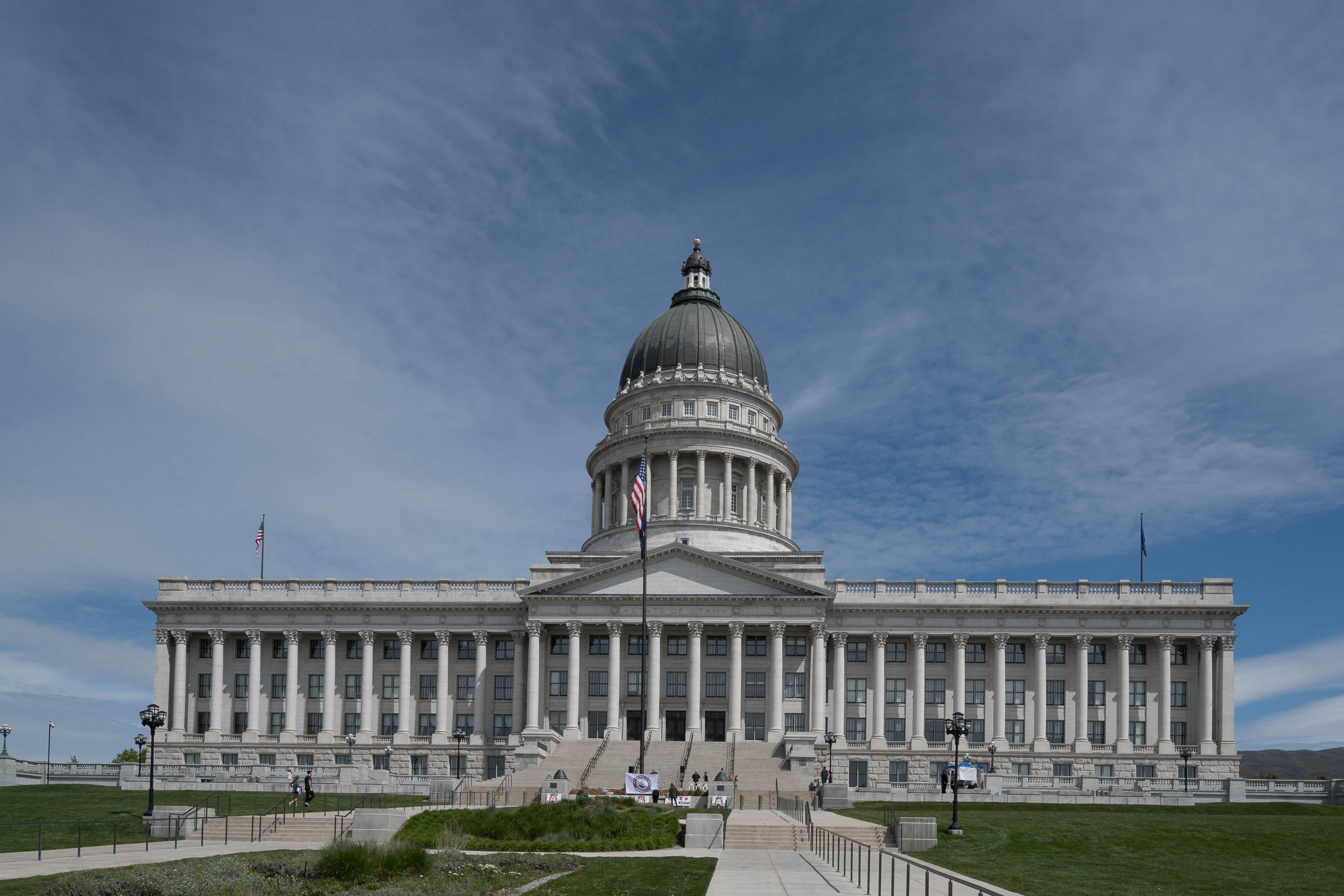
Salt Lake City (2017)
Salt Lake City is the capitol of Utah. THe downtown city center is very small. In the area are a lot of churches, the Capitol, but no skyscrapers.
Capitol, Salt Lake City (UT, 2017)
Salt Lake Temple in Salt Lake City (UT, 2017)
Capitol inside, Salt Lake City (UT, 2017)
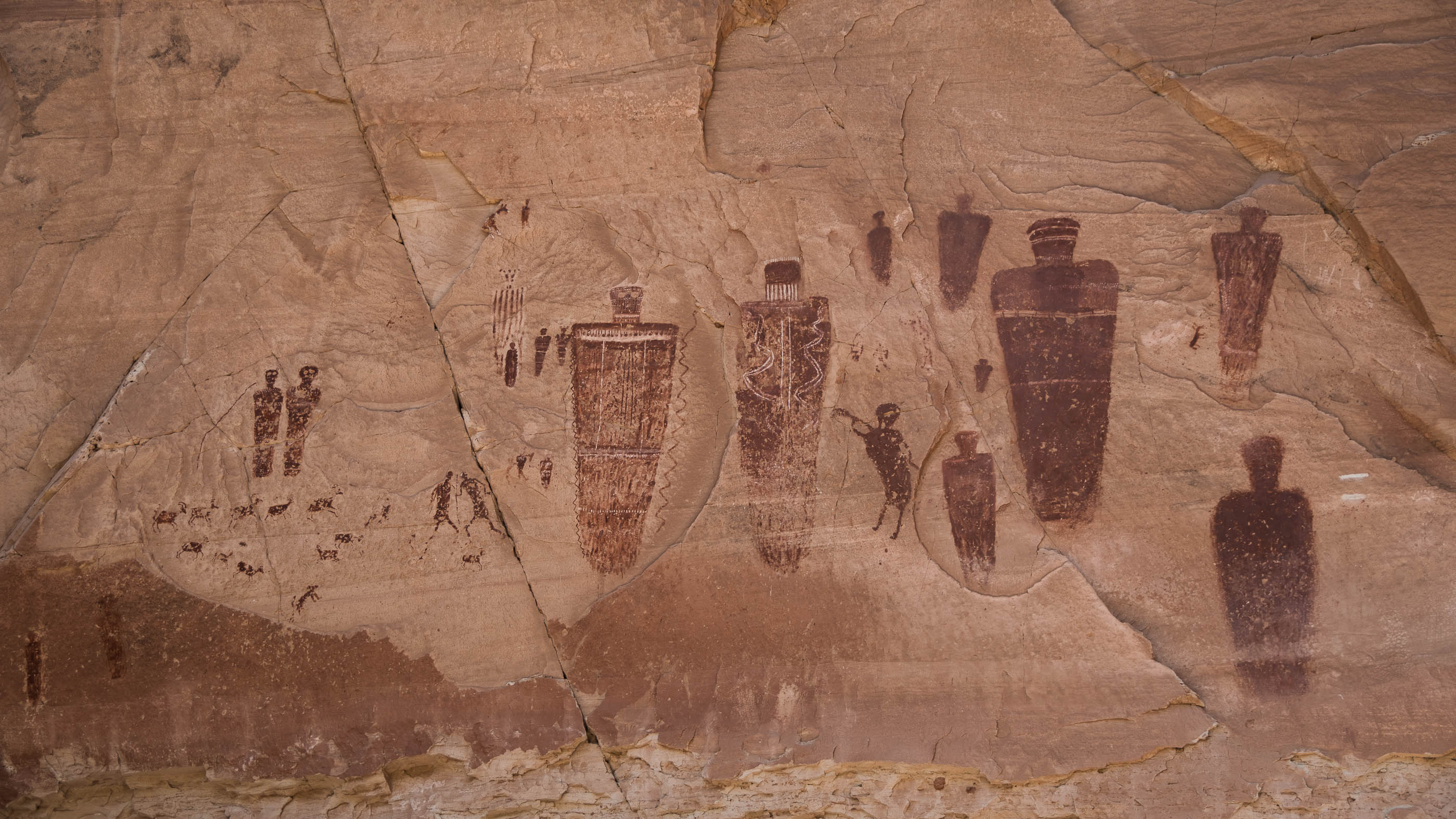
Sego Canyon (2017)
The site harbors rock art of 3 ancient American cultures: Ute, Fremont and Barrier. The Barrier panel is the most spectacular one, this panel dates from 6000 BC to 100 BC. Next to the road and close to the rock art a small arch can be found.
Rock art in Sego Canyon (UT, 2017)
Petroglyphs Arch in Sego Canyon (UT, 2017)
Snow Canyon State Park (2017)
This park was a surprise. There are lots of things to see here: dunes, a cinder cone volcano, many volcanic rocks, lava tubes, a short slot canyon and many red rocks.
Snow Canyon State Park (UT, 2017)
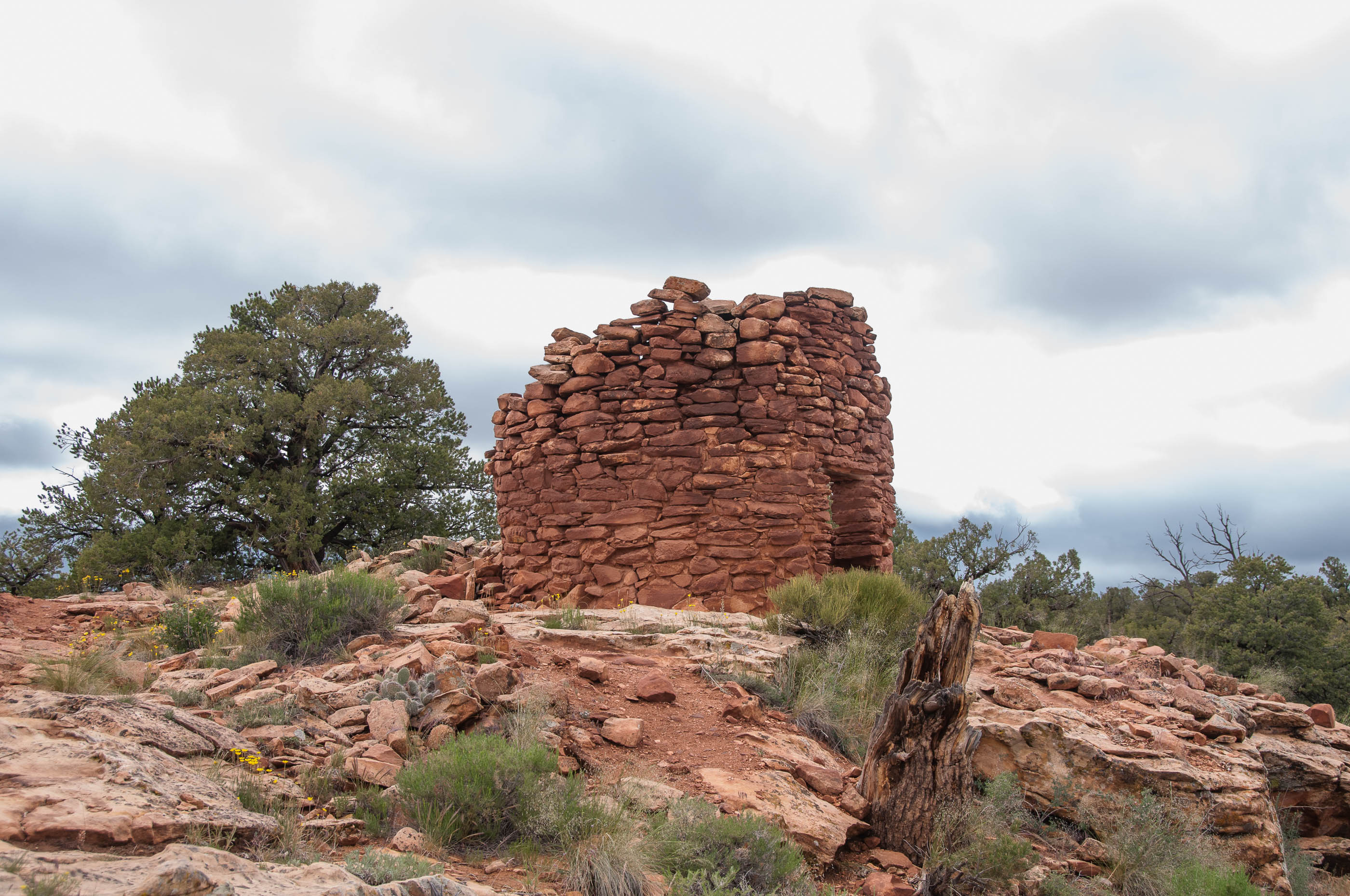
7 Towers on the Rim (2014)
The ruins of the 7 towers are in Mule Canyon. Not much is left, 1 tower is only partly collapsed. The ruins are accessible via a dirt road on which high clearance is needed. These ruins are not so interesting as House on FIre Ruin and Fallen Roof Ruin.
7 Towers on the Rim (UT, 2014)
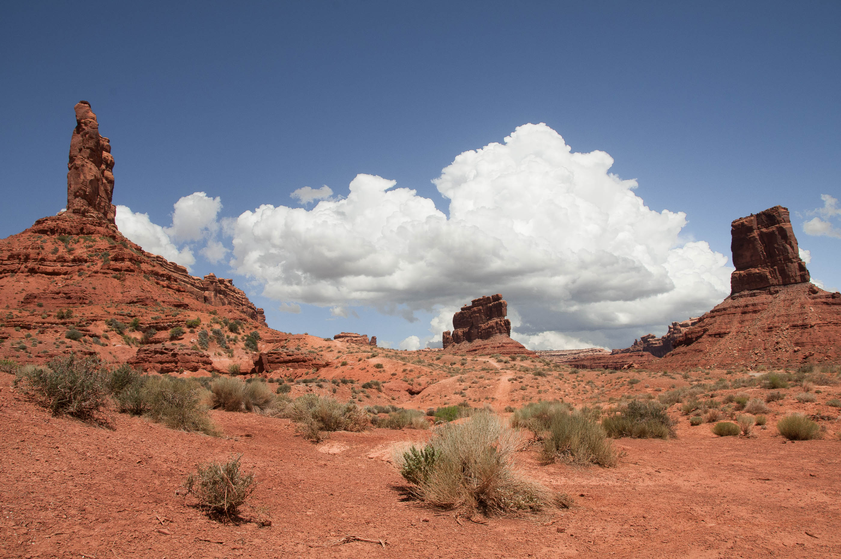
Valley of the Gods (2014)
These monoliths are in an area that is accessible via a dirt road. It is similar to Monument Valley, but a lot smaller.
Valley of the Gods (UT, 2014)
Valley of the Gods (UT, 2014)
Yant Flat (2017)
The specialty of Yant Flat are the very colorful and patterned rock formations. It is accessible via a 17 kilometer one way dirt road. The road is not of very good quality, high clearance is really needed. In some places the road is very narrow with a big drop directly next to it. The area is very interesting to visit.
Yant Flat (UT, 2017)
Zion National Park (2014)
Zion is known to be one of the busiest parks, so transport in the park is organised with shuttle buses. Every 7-8 minutes a bus arrives at the parking near the visitor center, so waits are never long. All trails are close to the bus stops: Upper Emerals Pool, the Narrows, Big Bend view point, Weeping Rock. Longer hikes are also possible: to Observation point. The hike is 8 miles long, round trip took us 4 hours, elevation 655 meters. In 2014 we just passed the park enroute to Bryce, we stopped at viewpoints only.